   |
Vital Statistics:
| Length: | 5mls (8km) |
| Ascent: | 843ft (257m) |
| Time: | 2½hrs |
| Grade: |  |
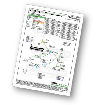
Route outline for walk gw135:
Llandderfel - Llyn Bodweni - Afron Dyfrdwy (River Dee) - Bryn-Banon - Coed Bryn Banon - Ty'n-y-bwlch - Llyn Maes-y-clawydd - Coed Hen-blas - Llandderfel
You can find more walks near this one on these unique free-to-access Interactive Walk Planning Maps: (click/TAP to select)
1:25,000 scale OS Explorer Map (the ones with orange/yellow covers):
1:50,000 scale OS Landranger Map (the ones with pink/magenta covers):
Send us your photographs and pictures from your walks and hikes
We would love to see your photographs and pictures from walk gw135 Bryn Banon from Llandderfel. Send them in to us as email attachments (configured for any computer) along with your name and where the picture was taken to:
and we shall do our best to publish them.
(Guide Resolution = 300dpi. At least = 660 pixels (wide) x 440 pixels (high).)

You can also submit photos from walk gw135 Bryn Banon from Llandderfel via our Facebook Page.
NB. Please indicate where each photo was taken.
To contribute to go4awalk.com or to contact us about anything at all - see Talk To Us. For help see Help.
go4awalk.com and go4awalk.co.uk are registered trademarks of TMDH Limited.
Copyright © 2000-2024 TMDH Limited. All rights reserved.
Copyright | Terms & Conditions | Privacy Statement
A - Z
Walks
Home
Log On/Accounts
Photo Gallery
Walk Ideas and Collections
Fell Facts
Places to Stay
Hill Skills
Walking Questions and Answers
Your Stories
News
Competitions
Product Reviews/Gear Tests
Walking Gear Guides
Peaks and Mountains
Peak Bagging
Find New Walking Friends
Camping
GPS Waypoints for Walking
Walk Search
Talk to us
go4awalk.com Help
Free example walks
Newsletter


