Walk ad112 Beinn Bhrotain and Monadh Mor from Corrour Bothy
High lonely mountains, but access is tricky
NB. Corrour Bothy is located the middle of Lairig Ghru and inaccessible by car. The nearest car park (by foot/mountain bike) is at Linn of Dee, W of Braemar - see walks ad125 and ad126 for route details.
   |
Vital Statistics:
| Length: | 12¾mls (20.5km) |
| Ascent: | 3,243ft (988m) |
| Time: | 8hrs |
| Grade: |  |
Route outline for walk ad112:
Corrour Bothy - Lairig Ghru - River Dee - Glen Dee - Coachan Roibidh - Coire Coachan Roibidh - Beinn Bhrotain (East Top) - Coire an t-Sneachda - Beinn Bhrotain - Core Cath Nam Fionn - Leac Ghorm - Monadh Mor - Allt Luineas - Loch Nan Stuirteng - Allt Clais an t-Sabhail - Allt A`Coire Cath Nam Fionn - Glen Geusachan - Geusachan Burn - River Dee - Corrour Bothy - Lairig Ghru.
Points of Interest/Notes on this walk:
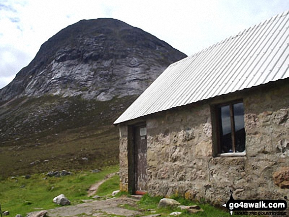
The single roomed Corrour Bothy gets pretty busy, particularly in the summer months. Either get there early to secure a place on the concrete floor or bring a tent and camp outside (as I did).
Peaks, Summits and Tops reached on this walk:
 2 Munros |
 0 Corbetts |
 0 Grahams |
 2 Murdos |
 0 Donalds |
 1 Scottish Marilyn |
 0 Bridgets |
Peak Bagging Statistics for this walk:
The highest point of this walk is Beinn Bhrotain at 1157m (3797ft). Beinn Bhrotain is classified as a Munro (No. 19) and a Scottish Marilyn (15th highest in Scotland, 15th highest in the UK). Beinn Bhrotain is also known as a Murdo (27th highest in Scotland). The summit of Beinn Bhrotain is marked by an Ordnance Survey Trig Point.
Completing this walk will also take you to the top of Monadh Mor at 1113m (3653ft). Monadh Mor is classified as a Munro (No. 40) Monadh Mor is also known as a Murdo (53rd highest in Scotland).
You will also reach the summit of Beinn Bhrotain (East Top) at 1108m (3636ft). Beinn Bhrotain (East Top) is Unclassified
You can find more walks near this one on these unique free-to-access Interactive Walk Planning Maps: (click/TAP to select)
1:25,000 scale OS Explorer Map (the ones with orange/yellow covers):
1:50,000 scale OS Landranger Maps (the ones with pink/magenta covers):
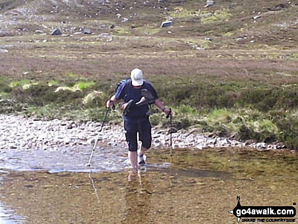
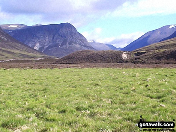
Some Photos and Pictures from Walk ad112 Beinn Bhrotain and Monadh Mor from Corrour Bothy
In no particular order . . .
Send us your photographs and pictures from your walks and hikes
We would love to see your photographs and pictures from walk ad112 Beinn Bhrotain and Monadh Mor from Corrour Bothy. Send them in to us as email attachments (configured for any computer) along with your name and where the picture was taken to:
and we shall do our best to publish them.
(Guide Resolution = 300dpi. At least = 660 pixels (wide) x 440 pixels (high).)

You can also submit photos from walk ad112 Beinn Bhrotain and Monadh Mor from Corrour Bothy via our Facebook Page.
NB. Please indicate where each photo was taken.
To contribute to go4awalk.com or to contact us about anything at all - see Talk To Us. For help see Help.
go4awalk.com and go4awalk.co.uk are registered trademarks of TMDH Limited.
Copyright © 2000-2024 TMDH Limited. All rights reserved.
Copyright | Terms & Conditions | Privacy Statement
A - Z
Walks
Home
Log On/Accounts
Photo Gallery
Walk Ideas and Collections
Fell Facts
Places to Stay
Hill Skills
Walking Questions and Answers
Your Stories
News
Competitions
Product Reviews/Gear Tests
Walking Gear Guides
Peaks and Mountains
Peak Bagging
Find New Walking Friends
Camping
GPS Waypoints for Walking
Walk Search
Talk to us
go4awalk.com Help
Free example walks
Newsletter


