The 30 nearest, easy-to-follow, circular walks, routes & maps to UK Postcode SS11
The thirty nearest, easy-to-follow, circular walks, routes & maps to UK Postcode SS11 in Walk Grade Order
   |
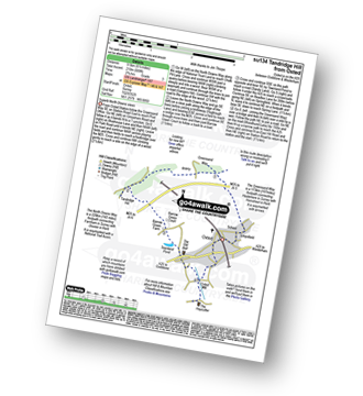
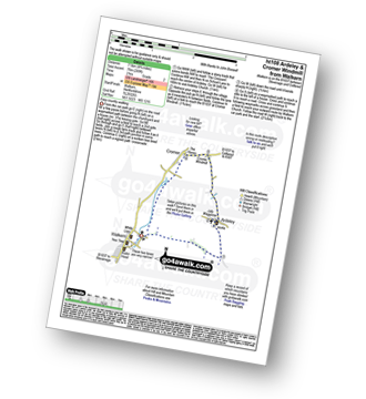
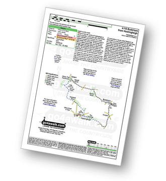
Vital Statistics:
| Length: | 7 miles (11 km) |
| Ascent: | 650ft (198m) |
| Time: | 3.25hrs |
| Grade: |  |
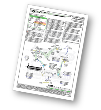
Route Summary:
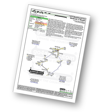
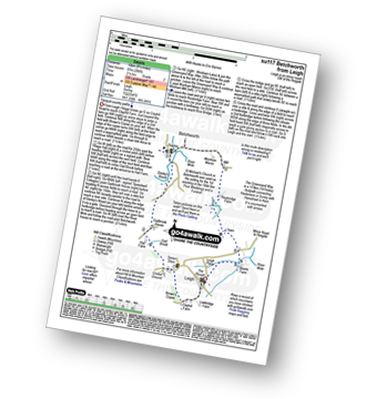
Thorndon Country Park North - Thorndon Park - Thorndon Hall - Ingrave - Herongate - Thorndon Country Park South - Old Hall Pond - Pigeon Mount - Jury Hill - Childerditch Pond - Scrub Hill - Countryside Centre - Thorndon Country Park North
|
Vital Statistics:
| Length: | 9 miles (14.5 km) |
| Ascent: | 256ft (78m) |
| Time: | 3.75hrs |
| Grade: |  |
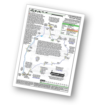
Route Summary:
Takeley - Hope End Green - Cow Common - Hellman's Cross - Taverners Green - Hatfield Broad Oak - Three Forests Way - Pincy Brook - Bush End - Harcamlow Way - The Flitch Way - Takeley
|
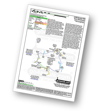
Vital Statistics:
| Length: | 7.25 miles (11.5 km) |
| Ascent: | 840ft (256m) |
| Time: | 3½ hrs |
| Grade: |  |
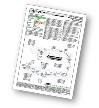
Route Summary:
Romney Street - Courtfield Wood - Eastdown - Great Wood - Paine's Farm - Rowdon Hill - The North Downs Way - Rowdow Wood - Shorehill Farm - Otford Manor - Fab's Wood - Cotman's Ash - Summeryards Wood - Knockmill Wood - Highfield Piggery - Little East Hill Farm - Broom Wood - Romney Street
|
Vital Statistics:
| Length: | 9.5 miles (15 km) |
| Ascent: | 1,306ft (398m) |
| Time: | 4.75hrs |
| Grade: |  |
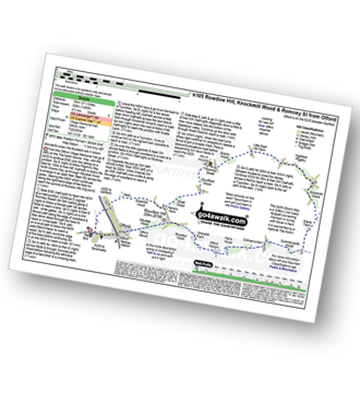
Route Summary:
Otford - The North Downs Way - Otford Mount - Hillydeal Wood - Rowdow Hill - Rowdow Wood - Shorehill Farm - Otford Manor - Fab's Wood - Cotman's Ash - Summeryards Wood - Knockmill Wood - Highfield Piggery - Little East Hill Farm - Broom Wood - Romney Street - Courtfield Wood - Eastdown - Great Wood - Paine's Farm - Greenhill Wood - Otford
|
Vital Statistics:
| Length: | 6.5 miles (9.5 km) |
| Ascent: | 689ft (210m) |
| Time: | 2.75hrs |
| Grade: | |
Route Summary:
Oxted - The Greensand Way - Limpsfield - The North Downs Way - Tandridge Hill - Townland Pool - Oxted Mill - The Greensand Way - Oxted
|
Vital Statistics:
| Length: | 4.5 miles (7 km) |
| Ascent: | 453ft (138m) |
| Time: | 2 hrs |
| Grade: | |
|
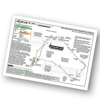
Vital Statistics:
| Length: | 6.25 miles (70 km) |
| Ascent: | 240ft (73m) |
| Time: | 2½ hrs |
| Grade: | |
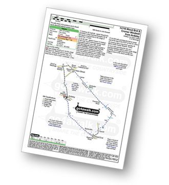
Route Summary:
Ardeley - Wood End - Roman Road - Hare Street - Roman Road - Hare Street - Cromer Windmill - Ardeley
|
Vital Statistics:
| Length: | 7.5 miles (12 km) |
| Ascent: | 315ft (96m) |
| Time: | 3 hrs |
| Grade: | |
|
Vital Statistics:
| Length: | 4.75 miles (7.5 km) |
| Ascent: | 249ft (76m) |
| Time: | 2 hrs |
| Grade: | |
|
Vital Statistics:
| Length: | 6.5 miles (10.5 km) |
| Ascent: | 542ft (165m) |
| Time: | 3 hrs |
| Grade: | |
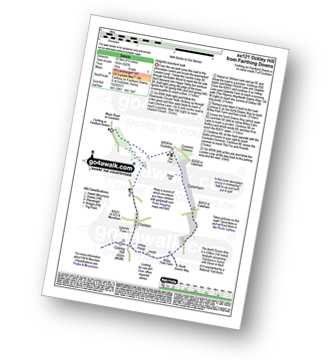
Route Summary:
Farthing Downs - Fairdean Downs - Chaldon Church - Chaldon - The North Downs Way - Ockley Hill - Hilltop House - Willey Park Farm - Caterham - Farthing Downs
|
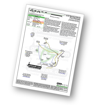
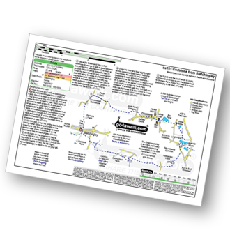
Vital Statistics:
| Length: | 4 miles (6.5 km) |
| Ascent: | 420ft (128m) |
| Time: | 2 hrs |
| Grade: | |
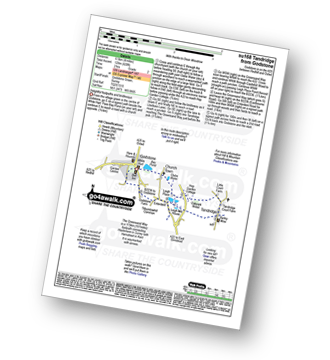
Route Summary:
Godstone - Glebe Water - Church Town - Leigh Place - Oakpark Wood - Tandridge - The Greensand Way - Enterdent - Tilburstowhill Common - Godstone
|
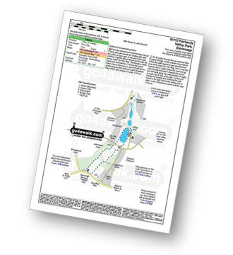
Vital Statistics:
| Length: | 2.25 miles (3.5 km) |
| Ascent: | 72ft (22m) |
| Time: | 1 hrs |
| Grade: |  |
|
Vital Statistics:
| Length: | 5.25 miles (8.5 km) |
| Ascent: | 407ft (124m) |
| Time: | 2.25hrs |
| Grade: | |
|
Vital Statistics:
| Length: | 3.75 miles (6 km) |
| Ascent: | 387ft (118m) |
| Time: | 1.75hrs |
| Grade: | |
Route Summary:
Chipstead - Chipstead Bottom - Fames Rough - Perrotts Farm - Ruffett Wood - Chipstead
|
Vital Statistics:
| Length: | 7.25 miles (11.5 km) |
| Ascent: | 381ft (116m) |
| Time: | 3 hrs |
| Grade: | |
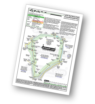
Route Summary:
Richmond Park - Pembroke Lodge - Hamcross Plantation - Ham Bottom - Park Gate - Kingston Gate - Robin Hood Gate - Beverley Brook - Roehampton Gate - Adam's Pond - Sheen Gate - The Bog - Richmond Gate - Richmond Park (Richmond Park) - Pembroke Lodge - Richmond Park
|
Vital Statistics:
| Length: | 7.25 miles (11.5 km) |
| Ascent: | 752ft (229m) |
| Time: | 3½ hrs |
| Grade: | |
Route Summary:
Bletchingley - The Greensand Way - Coldharbour Farm - Hobgarden Wood - Leigh Place - Glebe Water - Bay Pond - Godstone - Brewer Street - Bletchingley
|
Vital Statistics:
| Length: | 4.75 miles (7.5 km) |
| Ascent: | 466ft (142m) |
| Time: | 2.25hrs |
| Grade: | |
Route Summary:
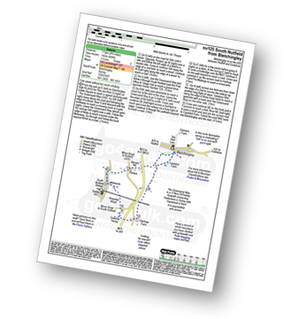
Bletchingley - The Greensand Way - Steners Hill - South Nutfield - Crabtree House - Henhaw Farm - Castlehill Farm - Bletchingley
|
Vital Statistics:
| Length: | 6.25 miles (10 km) |
| Ascent: | 141ft (43m) |
| Time: | 2½ hrs |
| Grade: | |
Route Summary:
Lingfield - Park Farm - Puttenden Manor - Haxted Watermill - River Eden - Eden Brook - Cernes Farm - Starborough Castle - St Piers School - Lingfield Railway Station - Lingfield
|
Vital Statistics:
| Length: | 6.75 miles (11 km) |
| Ascent: | 243ft (74m) |
| Time: | 2½ hrs |
| Grade: | |
Route Summary:
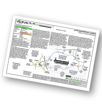
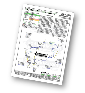
Blindley Heath - Ardenrun Farm - Crowhurst Place - Crowhurst - Ashen Plantations - Gays Cottages - Comforts Place Farm - Oak Tree Farm - Blindley Heath
|
Vital Statistics:
| Length: | 4.5 miles (7 km) |
| Ascent: | 207ft (63m) |
| Time: | 2 hrs |
| Grade: | |
Route Summary:
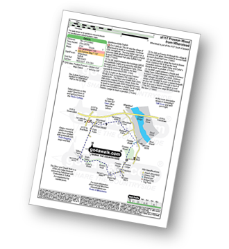
Wherstead - Wherstead Hall - Suffolk Food Hall - Redgate Farm - Freston Brook - The Stour and Orwell Walk - Freston Wood - Freston - Bond Hall Farm - Broom Knoll - Cutler's Wood - Stalls Valley - Valley Farm - Park Farm - Wherstead
|
Vital Statistics:
| Length: | 3.75 miles (6 km) |
| Ascent: | 161ft (49m) |
| Time: | 1½ hrs |
| Grade: | |
Route Summary:
Garlinge - Westbrook - Nr Margate - Minster Rd - Shottendane Rd - Woodchurch - Archer Farm - Hengrove Farm - Garlinge
|
Vital Statistics:
| Length: | 5.5 miles (9 km) |
| Ascent: | 466ft (142m) |
| Time: | 2½ hrs |
| Grade: | |
Route Summary:
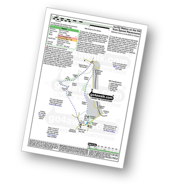
Tattenham Corner - Epsom Downs Racecourse - Langley Cale - The Warren - Nohome Farm - Downs View Wood - Walton On The Hill - The Nere - Withybed Corner - Walton Downs - Tattenham Corner - Epsom Downs Racecourse.
|
Vital Statistics:
| Length: | 7.5 miles (12 km) |
| Ascent: | 417ft (127m) |
| Time: | 3.25hrs |
| Grade: | |
Route Summary:
Outwood - Windmill - Outwood Common - Shepheard's Hurst - Burstow Farm - Henshaw Farm - Laundry Cottage - Cuckseys Farm - Poundhill Wood - Outwood Swan Sanctuary - Outwood
|
Vital Statistics:
| Length: | 6.5 miles (10 km) |
| Ascent: | 82ft (25m) |
| Time: | 2½ hrs |
| Grade: | |
Route Summary:
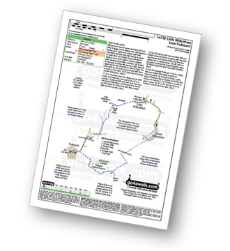
Fulbourn - Harcamlow Way - Cole's Bridge - New Cut Drain - Hawk Mill Farm - Little Wilbraham - Great Wilbraham - Fleam Dyke - Fulbourn
|
Vital Statistics:
| Length: | 6.25 miles (10 km) |
| Ascent: | 286ft (87m) |
| Time: | 2½ hrs |
| Grade: | |
Route Summary:
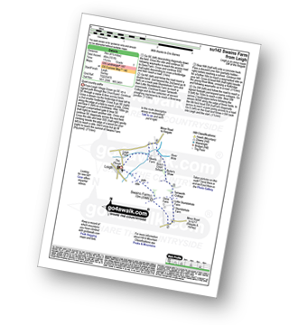
Leigh - Clayhill Farm - Gad Brook - Denby's Wood - St Michael's Church - Betchworth - Wonham Manor - Ricebridge Farm - Skeets Farm - Leigh
|
Vital Statistics:
| Length: | 4.5 miles (7 km) |
| Ascent: | 151ft (46m) |
| Time: | 1.75hrs |
| Grade: | |
|
Vital Statistics:
| Length: | 7 miles (11 km) |
| Ascent: | 962ft (293m) |
| Time: | 3½ hrs |
| Grade: | |
Route Summary:
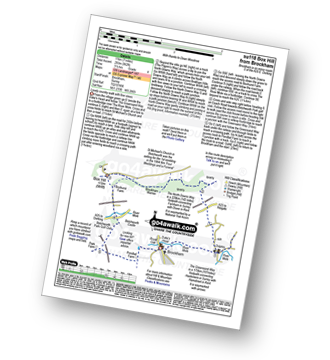
Brockham - The Greensand Way - St Michael's Church - Betchworth - The North Downs Way - Brockham Warren - Box Hill - Betchworth Park Golf Club - Park Farm - Pondtail Farm - Brockham
|
Vital Statistics:
| Length: | 2.75 miles (4.5 km) |
| Ascent: | 151ft (46m) |
| Time: | 1.25hrs |
| Grade: | |
Route Summary:
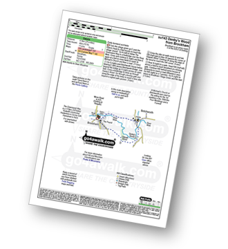
Brockham - The Greensand Way - The River Mole - St Michael's Church - Betchworth - Denby's Wood - Oldpark Wood - Brockham
|
Vital Statistics:
| Length: | 7 miles (11 km) |
| Ascent: | 1,115ft (340m) |
| Time: | 3½ hrs |
| Grade: | |
Route Summary:
Car Park S of Mickleham - River Mole - Norbury Park House - Fetcham Downs - Westhumble - The North Downs Way - Box Hill - Car Park S of Mickleham
|
Vital Statistics:
| Length: | 4.5 miles (7 km) |
| Ascent: | 236ft (72m) |
| Time: | 2 hrs |
| Grade: | |
Route Summary:
Charlwood - The Sussex Border Path - Barfield Farm - Greenings Farm - Glover's Wood Nature Reserve - Charlwood


