The 30 nearest, easy-to-follow, circular walks, routes & maps to UK Postcode SK1
The thirty nearest, easy-to-follow, circular walks, routes & maps to UK Postcode SK1 in Walk Grade Order
   |
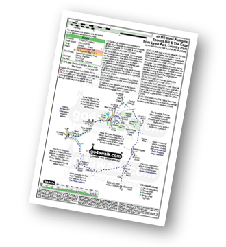
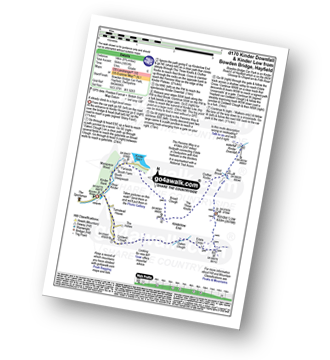
Vital Statistics:
| Length: | 7 miles (11 km) |
| Ascent: | 824ft (251m) |
| Time: | 3.25hrs |
| Grade: |  |
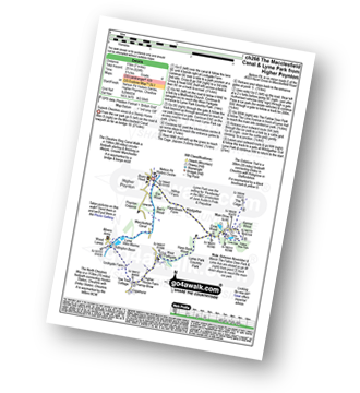
Route Summary:
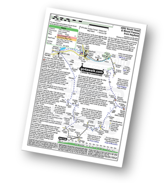
Nelson Pit Visitors Centre - Higher Poynton - The Macclesfield Canal - The Cheshire Ring Canal Walk - Wood Lanes - Adlington Basin - Lockgate Farm - The North Cheshire Way - Harrop Brow - West Parkgate - Lyme Park Country Park - Lyme Park Car Park - The Cage - Lyme Hall - Fallow Deer Park - The Lime Avenue - Lyme Park Car Park - Windgather Farm - Haresteads Farm - Nelson Pit Visitors Centre - Higher Poynton.
|
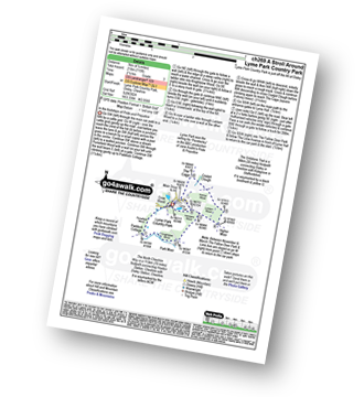
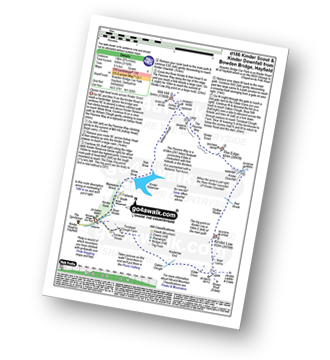
Vital Statistics:
| Length: | 9.75 miles (15.5 km) |
| Ascent: | 9ft (409m) |
| Time: | 5 hrs |
| Grade: |  |
Route Summary:
Nelson Pit Visitors Centre - Higher Poynton - The Macclesfield Canal - The Cheshire Ring Canal Walk - Wood Lanes - Adlington Basin - Lockgate Farm - The North Cheshire Way - Harrop Brow - Birchencliff Farm - Keeper's Cottage - Dale Top - Sponds Moor - The Gritstone Trail - Sponds Hill - Bowstonegate Farm - Bow Stones - Higher Moor - Lyme Park Country Park - Lantern Wood - The Cage - Lyme Hall - Fallow Deer Park - The Lime Avenue - Lyme Park Car Park - Windgather Farm - Haresteads Farm - Nelson Pit Visitors Centre - Higher Poynton.
|
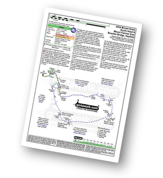
Vital Statistics:
| Length: | 9.5 miles (15 km) |
| Ascent: | 1,696ft (517m) |
| Time: | 5.25hrs |
| Grade: |  |
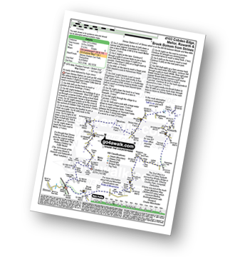
Route Summary:
Strines Station - Lower Cliffe Cottage - Higher Banks Cottage - Cobden Edge - Mellor Moor - Mellor - Mellor Church - Hilltop Farm - Shiloh Hall Farm - Ringstones Farm - Ayton Farm - Rowarth - Thornsett Fields Farm - New Mills - Whitle - Brook Bottom - The Goyt Way - The Midshires Way - Strines Station
|
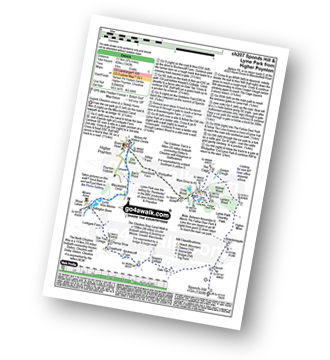
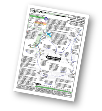
Vital Statistics:
| Length: | 4.5 miles (7 km) |
| Ascent: | 715ft (218m) |
| Time: | 2½ hrs |
| Grade: |  |
Route Summary:
Lyme Park Car Park - Lyme Park Country Park - Pursefield Wood - Paddock Cottage,Knightslow Wood, - Higher Moor - Lantern Wood - The Cage - The North Cheshire Way - Lyme Hall - Lyme Park Car Park
|
Vital Statistics:
| Length: | 7.25 miles (11.5 km) |
| Ascent: | 1,201ft (366m) |
| Time: | 3.75hrs |
| Grade: | |
Route Summary:
Lyme Park Car Park - Crow Wood - Hase Bank Wood - West Parkgate - The North Cheshire Way - Keepers' Cottage - Dale Top - Sponds Moor - The Gritstone Trail - Sponds Hill - Bow Stones - Bowstonegate Farm - Lyme Park Country Park - Lantern Wood - The Cage - Fallow Deer Park - The Lime Avenue - Lyme Park Car Park
|
Vital Statistics:
| Length: | 5.5 miles (9 km) |
| Ascent: | 499ft (152m) |
| Time: | 2.75hrs |
| Grade: | |
Route Summary:
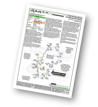
Twinnies Bridge - Wilmslow - Moss Grove Farm - Morely - The River Bollin - Styal Country Park - Giant's Castle Bridge - Oxbrow Bridge - Kingfisher Bridge - Norcliffe Church - Styal Cross - Styal - Quarry Bank Mill - Twinnies Bridge - Wilmslow.
|
Vital Statistics:
| Length: | 6.5 miles (10.5 km) |
| Ascent: | 167ft (51m) |
| Time: | 2.75hrs |
| Grade: |  |
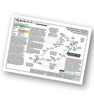
Route Summary:
Lindow Common - Wilmslow - Lindow Moss - Morley Green - Rossmere - Saltersley Hall Farm - Mobberley Golf Club - Graveyard Farm - Knolls Green - Paddockhill - Plough and Flail - Racecourse Farm - Lindow Common - Wilmslow.
|
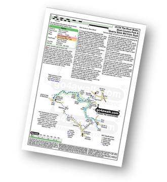
Vital Statistics:
| Length: | 3.75 miles (6 km) |
| Ascent: | 820ft (250m) |
| Time: | 2.25hrs |
| Grade: | |
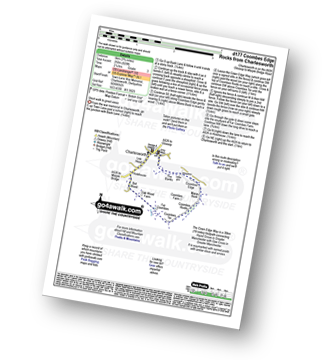
Route Summary:
Charlesworth - The Banks - The Cown Edge Way - Coombes Edge - Coombes Rocks - Coombes Tor - Far Coombes - Oak Wood Farm - Bot Wood - Holehouse - Charlesworth
|
Vital Statistics:
| Length: | 5.75 miles (9 km) |
| Ascent: | 354ft (108m) |
| Time: | 2½ hrs |
| Grade: | |
Route Summary:
Mottram St Andrew - River Bollin - Willot Nurseries - Top O' Th' Hill Farm - Mottram Hall Golf Course - Mottram Hall - Woodside Farm - Legh Hall - Hunters Pool - Goose Green Farm - Mottram St Andrew
|
Vital Statistics:
| Length: | 4 miles (6.5 km) |
| Ascent: | 272ft (83m) |
| Time: | 1.75hrs |
| Grade: | |
Route Summary:
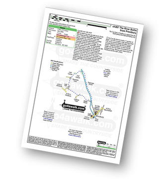
Prestbury - The River Bollin - The North Cheshire Way - Woodside Farm - Legh Hall - Woodend Farm - Spittle House - Prestbury
|
Vital Statistics:
| Length: | 8.75 miles (14 km) |
| Ascent: | 1,050ft (320m) |
| Time: | 4.25hrs |
| Grade: | |
Route Summary:
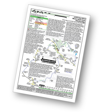
Alderley Edge - Clock House Farm - Daniel Hill - Daniel Wood - Alder Wood - Hare Hill - Finlow Hill Wood - Clinton Hill - Birtles Hill - Fernhill - Monk's Heath - Yarwoods Farm - Heawood House - Nether Alderley Mill - Nether Alderley - Alderley Edge
|
Vital Statistics:
| Length: | 5 miles (8 km) |
| Ascent: | 1,162ft (354m) |
| Time: | 3 hrs |
| Grade: | |

Route Summary:
Chunal Road (Glossop) - A624 - The Grouse Inn - Burnt Hill - Mill Hill - The Knott (Hayfield) - Hollingworth Clough - Tom Heys Farm - The Grouse Inn - A624 - Chunal Road (Glossop)
|
Vital Statistics:
| Length: | 8.5 miles (13.5 km) |
| Ascent: | 453ft (138m) |
| Time: | 3½ hrs |
| Grade: | |
Route Summary:
Hale (near Altrincham) - The River Bollin - The Bollin Valley Way - Coppice Farm - Ryecroft Farm - Birkin Farm - Birtles Farm - New Mills - Breach House Farm - Higherhouse Farm - The River Bollin - Ross Mill - Hale.
|
Vital Statistics:
| Length: | 10.5 miles (17 km) |
| Ascent: | 2,468ft (752m) |
| Time: | 6.25hrs |
| Grade: | |
Route Summary:
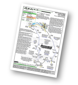
Hayfield - Sett Valley Trail - Birch Vale - Morland Road - Ollersett - New Allotments - Cracken Edge - Chinley Churn - Chinley Head - Dry Clough Farm - Chinley - Naze House - Greystead - Alder Ling - Wicken House - Andrews Farm - South Head (Hayfield) - Mount Famine - Elle Bank - Pennine Bridleway - Tunstead House - Bowden Bridge - Hayfield
|
Vital Statistics:
| Length: | 8.75 miles (14 km) |
| Ascent: | 1,861ft (567m) |
| Time: | 5 hrs |
| Grade: | |
Route Summary:
Hayfield - Sett Valley Trail - Birch Vale - Morland Road - Ollersett - New Allotments - Chinley Churn - Cracken Edge - Chinley - Vorposten - Hayfield
|
Vital Statistics:
| Length: | 9.5 miles (15 km) |
| Ascent: | 2,074ft (632m) |
| Time: | 5½ hrs |
| Grade: | |
Route Summary:
Hayfield - Sett Valley Trail - Birch Vale - The River Sett - The Pennine Bridleway - Lantern Pike - Matley Moor - Burnt Hill - Mill Hill (Ashop Head) - The Pennine Way - William Clough - Kinder Reservoir - Snake Path - Middle Moor - Hayfield
|
Vital Statistics:
| Length: | 4.75 miles (7.5 km) |
| Ascent: | 843ft (257m) |
| Time: | 2.75hrs |
| Grade: | |
Route Summary:
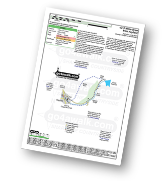
Hayfield - Sett Valley Trail Car Park - Valley Road - Bowden Bridge Car Park - Kinder Road - Kinder Reservoir - White Brow - Middle Moor (Hayfield) - Snake Path - Sett Valley Trail Car Park - Hayfield
|
Vital Statistics:
| Length: | 4.75 miles (7.5 km) |
| Ascent: | 899ft (274m) |
| Time: | 2.75hrs |
| Grade: | |
Route Summary:
Hayfield - Sett Valley Trail - Birch Vale - The River Sett - The Pennine Bridleway - Lantern Pike - Hey Wood - Little Hayfield - Sett Valley Trail - Hayfield
|
Vital Statistics:
| Length: | 13.5 miles (21.5 km) |
| Ascent: | 2,914ft (888m) |
| Time: | 7.75hrs |
| Grade: |  |
Route Summary:
Hayfield - Sett Valley Trail - Birch Vale - Morland Road - Ollersett - New Allotments - Chinley Head - Mount Famine - South Head (Hayfield) - Brown Knoll (Edale) - Edale Cross - Oaken Clough - Coldwell Clough - Tunstead House - Bowden Bridge - Hayfield
|
Vital Statistics:
| Length: | 10.5 miles (17 km) |
| Ascent: | 2,055ft (626m) |
| Time: | 6 hrs |
| Grade: | |
Route Summary:
Hayfield - Sett Valley Trail - Birch Vale - The River Sett - The Pennine Bridleway - Lantern Pike - Rowarth - Cown Edge Rocks - Chunal Road (Glossop) - Hollingwood Clough - Middle Moor (Hayfield) - The Snake Path - Hayfield
|
Vital Statistics:
| Length: | 12.5 miles (20 km) |
| Ascent: | 2,143ft (653m) |
| Time: | 6.75hrs |
| Grade: | |
Route Summary:
Hadfield - The Longdenden Trail - Tintwistle - Arnfield Gamekeepers Cottage - Arnfield Brook - Arnfield Farm - Tintwistle Low Moor - Ogden Brook - Arnfield Moor - Arnfield Flats - Ormes Moor - Wilderness - Windgate Edge - Blindstones Moor - Featherbed Moss (Chew Reservoir) - Laddow Moss - Black Chew Head (Laddow Rocks) - The Pennine Way - Oakenclough Brook - Rakes Rocks - Highstone Rocks - Torside Reservoir - Rhodeswood Reservoir - The Longdendale Trail - Hadfield
|
Vital Statistics:
| Length: | 8.75 miles (14 km) |
| Ascent: | 1,851ft (564m) |
| Time: | 5 hrs |
| Grade: | |
Route Summary:
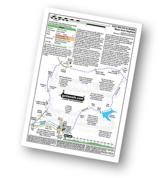
Bowden Bridge - Hayfield - Booth Sheepwash - Farlands - Broad Clough - Kinderlow End - Three Knolls - Cluther Rocks - Red Brook - The Pennine Way - Kinder Downfall - Kinder Low (Kinder Scout) - Edale Cross - Oaken Clough - Coldwell Clough - Bowden Bridge - Hayfield
|
Vital Statistics:
| Length: | 8.75 miles (14 km) |
| Ascent: | 2,192ft (688m) |
| Time: | 5½ hrs |
| Grade: | |
Route Summary:
Bowden Bridge - Hayfield - Booth Sheepwash - White Brow - Kinder Reservoir - Nab Brow - William Clough - Ashop Head - Mill Hill (Ashop Head) - The Pennine Way - Kinder Scout - The Edge (Kinder Scout) - Kinder Downfall - Red Brook - Cluther Rocks - Kinder Low (Kinder Scout) - Edale Cross - Kinderlow End - Oaken Clough - Tunstead House Farm - Bowden Bridge - Hayfield
|
Vital Statistics:
| Length: | 7.5 miles (12 km) |
| Ascent: | 1,808ft (551m) |
| Time: | 4½ hrs |
| Grade: | |
Route Summary:
Bowden Bridge - Hayfield - Turnstead House - Coldwell Clough - Oaken Clough - Edale Cross - Brown Knoll (Edale) - South Head (Hayfield) - Mount Famine - Elle Bank - The Pennine Bridleway - Tunstead House - Bowden Bridge - Hayfield
|
Vital Statistics:
| Length: | 10.75 miles (17 km) |
| Ascent: | 2,242ft (683m) |
| Time: | 6.25hrs |
| Grade: | |
Route Summary:
Bowden Bridge - Hayfield - Booth Sheepwash - Farlands - Broad Clough - Kinderlow End - Three Knolls - Cluther Rocks - Red Brook - The Pennine Way - Kinder Downfall - Kinder Low (Kinder Scout) - Brown Knoll (Edale) - South Head (Hayfield) - Mount Famine - Elle Bank - The Pennine Bridleway - Tunstead House - Hayfield
|
Vital Statistics:
| Length: | 7.25 miles (11.5 km) |
| Ascent: | 1,526ft (465m) |
| Time: | 4.25hrs |
| Grade: | |
Route Summary:
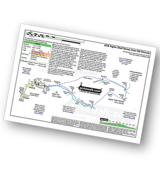
Old Glossop - Shittern Clough - Lightside - Yellow Slacks - Dowstone Clough - Dog Rock - Higher Shelf Stones - James's Thorn - Doctors Gate Path - Shelf Brook - Moss Lea Farm - Old Glossop
|
Vital Statistics:
| Length: | 9 miles (14.5 km) |
| Ascent: | 1,850ft (564m) |
| Time: | 5.25hrs |
| Grade: | |
Route Summary:
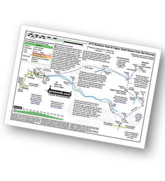
Old Glossop - Shittern Clough - Lightside - Yellow Slacks - Dog Rock - Dowstone Clough - Yellowslacks Brook - The Wain Stones (or Kissing Stones) - Bleaklow Head (Bleaklow Hill) - Higher Shelf Stones - Crooked Clough - The Pennine Way - Old Woman - Doctor's Gate Path - Shelf Brook - Moss Lea Farm - Old Glossop
|
Vital Statistics:
| Length: | 6.25 miles (10 km) |
| Ascent: | 1,451ft (442m) |
| Time: | 3.75hrs |
| Grade: | |
Route Summary:
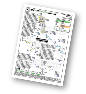
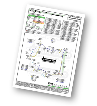
Pym Chair - Jenkin Chapel - Broad Moss - Saddle Cote - Moss Brook - Harrop Fold Farm - Black Brook - Charles Head Farm - Near Carr Farm - Fivelane-ends - Taxal Edge - Windgather Rocks - Goyt Forest - Ladbitch Wood - Pym Chair
|
Vital Statistics:
| Length: | 6.25 miles (10 km) |
| Ascent: | 1,224ft (373m) |
| Time: | 3½ hrs |
| Grade: | |
Route Summary:
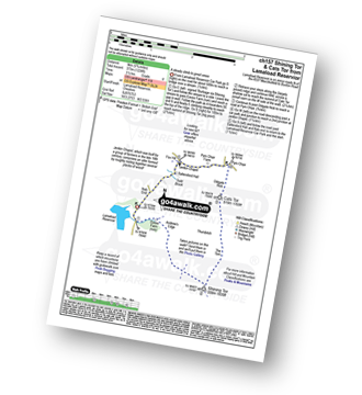
Lamaload Reservoir - Shining Tor - Cats Tor - Pym Chair - Jenkin Chapel - Lamaload Reservoir
|
Vital Statistics:
| Length: | 9.5 miles (15 km) |
| Ascent: | 1,611ft (491m) |
| Time: | 5 hrs |
| Grade: | |
Route Summary:
Lamaload Reservoir - Saltersford Hall - Jenkin Chapel - Kettleshulme - Windgather Rocks - Pym Chair - Cats Tor - Shining Tor - Lamaload Reservoir


