Walks Routes Maps from Worth Matravers in The Dorset Downs, Dorset in Walk Grade Order
Route maps for Walks that start, or go through, Worth Matravers in The Dorset Downs, Dorset, England in Walk Grade Order
Details of refreshments, pubs & parking are included on each Worth Matravers walk description.
   |
Vital Statistics:
| Length: | 4.75 miles (7.5 km) |
| Ascent: | 754ft (230m) |
| Time: | 2½ hrs |
| Grade: |  |
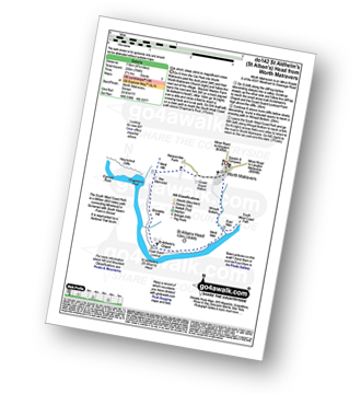
Route Summary:
Worth Matravers - The South West Coast Path - Emmetts Hill - St Aldhelm's (St Alban's) Head - St Aldhelm's Chapel - National Coastwatch Station St Alban's Head - West Man - Winspit - Winspit Bottom - Worth Matravers
|
Vital Statistics:
| Length: | 9.5 miles (15 km) |
| Ascent: | 1,388ft (423m) |
| Time: | 5 hrs |
| Grade: |  |
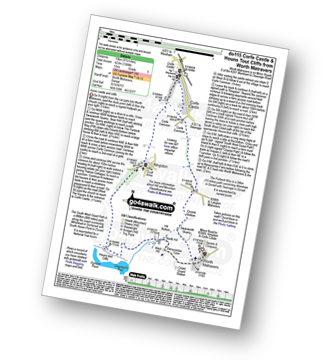
Route Summary:
Worth Matravers - Swanworth Quarry - The Purbeck Way - Coomb Bottom - Corfe Common - Corfe Castle - Corfe Common - Kingston - Houns-tout-Cliffs - The South West Coast Path - North Hill - West Hill - Renscombe Farm - Worth Matravers
Find more fantastic easy-to-follow circular walks in
To contribute to go4awalk.com or to contact us about anything at all - see Talk To Us. For help see Help.
go4awalk.com and go4awalk.co.uk are registered trademarks of TMDH Limited.
Copyright © 2000-2024 TMDH Limited. All rights reserved.
Copyright | Terms & Conditions | Privacy Statement
A - Z
Walks
Home
Log On/Accounts
Photo Gallery
Walk Ideas and Collections
Fell Facts
Places to Stay
Hill Skills
Walking Questions and Answers
Your Stories
News
Competitions
Product Reviews/Gear Tests
Walking Gear Guides
Peaks and Mountains
Peak Bagging
Find New Walking Friends
Camping
GPS Waypoints for Walking
Walk Search
Talk to us
go4awalk.com Help
Free example walks
Newsletter


