Walks Routes Maps from Church Stretton in The Shropshire Hills, Shropshire in Walk Grade Order
Route maps for Walks that start, or go through, Church Stretton in The Shropshire Hills, Shropshire, England in Walk Grade Order
Details of refreshments, pubs & parking are included on each Church Stretton walk description.
   |
Vital Statistics:
| Length: | 5.25 miles (8.5 km) |
| Ascent: | 945ft (288m) |
| Time: | 3 hrs |
| Grade: |  |
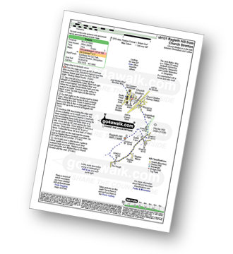
Route Summary:
Church Stretton - The Jack Mytton Way - Snatchfield Farm - Clemcroft - Ragleth Hill - Ragdon Manor - Church Stretton
|
Vital Statistics:
| Length: | 7 miles (11 km) |
| Ascent: | 1,214ft (370m) |
| Time: | 3.75hrs |
| Grade: |  |
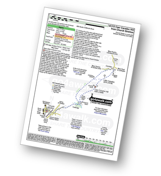
Route Summary:
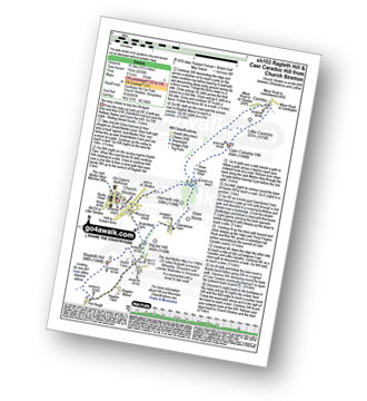
Church Stretton - Three Fingers Rock - Caer Caradoc Hill - Little Caradoc - Comley - Church Stretton
|
Vital Statistics:
| Length: | 5.75 miles (9 km) |
| Ascent: | 1,027ft (313m) |
| Time: | 3.25hrs |
| Grade: | |
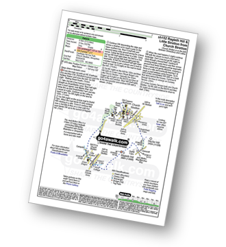
Route Summary:
Church Stretton - The Jack Mytton Way - Snatchfield Farm - Clemcroft - Ragleth Hill - Little Stretton - Church Stretton
|
Vital Statistics:
| Length: | 8.75 miles (14 km) |
| Ascent: | 1,387ft (423m) |
| Time: | 4.75hrs |
| Grade: |  |
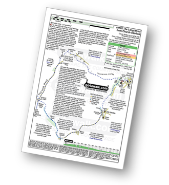
Route Summary:
Church Stretton - Town Brook - The Jack Mytton Way - The Long Mynd - Pole Bank (Long Mynd) - Midland Gliding Club - Minton Bach - Minton - Little Stretton - Chruch Stretton.
|
Vital Statistics:
| Length: | 10.25 miles (16.5 km) |
| Ascent: | 2,435ft (742m) |
| Time: | 6.25hrs |
| Grade: |  |
Route Summary:
Church Stretton - The Jack Mytton Way - Snatchfield Farm - Clemcroft - Ragleth Hill - Ragdon Manor - Gaerstones Farm - Caer Caradoc Hill - Little Caradoc - Church Stretton
Find more fantastic easy-to-follow circular walks in
To contribute to go4awalk.com or to contact us about anything at all - see Talk To Us. For help see Help.
go4awalk.com and go4awalk.co.uk are registered trademarks of TMDH Limited.
Copyright © 2000-2024 TMDH Limited. All rights reserved.
Copyright | Terms & Conditions | Privacy Statement
A - Z
Walks
Home
Log On/Accounts
Photo Gallery
Walk Ideas and Collections
Fell Facts
Places to Stay
Hill Skills
Walking Questions and Answers
Your Stories
News
Competitions
Product Reviews/Gear Tests
Walking Gear Guides
Peaks and Mountains
Peak Bagging
Find New Walking Friends
Camping
GPS Waypoints for Walking
Walk Search
Talk to us
go4awalk.com Help
Free example walks
Newsletter


