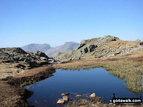
Walking and Hiking Photo:
Sca Fell (left) and Scafell Pike (centre) from Crinkle Crags (Long Top)
The Southern Fells,
The Lake District National Park,
Cumbria, England
The Southern Fells,
The Lake District National Park,
Cumbria, England
   |
Vital Statistics:
| Length: | 7.75 miles (12.5 km) |
| Ascent: | 2,770ft (844m) |
| Time: | 5.75hrs |
| Grade: |  |
Route Summary:
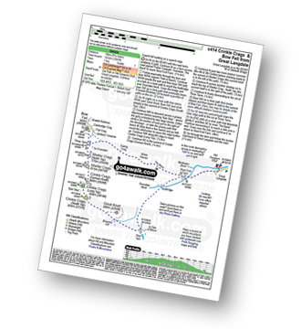
Great Langdale - Old Dungeon Ghyll - Stool End - Oxendale Beck - Browney Gill - Red Tarn (Langdale) - Great Knott - Crinkle Crags (South Top) - Crinkle Crags (Long Top) - Crinkle Crags (Gunson Knott) - Shelter Crags - Shelter Crags (North Top) - Three Tarns - Earing Crag - White Stones - The Band - Oxendale - Stool End Farm - The Old Dungeon Ghyll - Great Langdale
|
Vital Statistics:
| Length: | 11.25 miles (18 km) |
| Ascent: | 3,604ft (1,098m) |
| Time: | 7.75hrs |
| Grade: |  |
Route Summary:
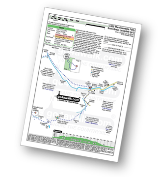
Great Langdale - The Old Dungeon Ghyll - Stool End Farm - Oxendale - Oxendale Beck - Browney Gill - Red Tarn (Langdale) - Great Knott - Crinkle Crags (South Top) - Crinkle Crags (Long Top) - Crinkle Crags (Gunson Knott) - Shelter Crags - Shelter Crags (North Top) - Three Tarns - Climbers' Traverse (optional) - Flat Crag - Cambridge Crag - Bowfell Buttress - Bow Fell (Bowfell) - Bow Fell (Bowfell) (North Top) - Ore Gap - Angle Tarn (Langdale) - Rossett Pike - Rossett Beck - Mickleden - Mickleden Beck - The Cumbria Way - The Old Dungeon Ghyll - Great Langdale
|
Vital Statistics:
| Length: | 10 miles (16 km) |
| Ascent: | 4,007ft (1,221m) |
| Time: | 7½ hrs |
| Grade: | |
Route Summary:
Great Langdale - The Old Dungeon Ghyll - Wall End Farm - Redacre Gill - Wrynose Fell - Pike of Blisco (Pike O' Blisco) - Red Tarn (Langdale) - Cold Pike - Cold Pike (West Top) - Cold Pike (Far West Top) - Great Knott - Little Stand - Great Knott - Crinkle Crags (South Top) - Crinkle Crags (Long Top) - Crinkle Crags (Gunson Knott) - Shelter Crags - Shelter Crags - (North Top) - Three Tarns - Earing Crag - White Stones - The Band - Oxendale - Stool End Farm - The Old Dungeon Ghyll - Great Langdale
|
Vital Statistics:
| Length: | 9 miles (14.5 km) |
| Ascent: | 3,387ft (1,032m) |
| Time: | 6.75hrs |
| Grade: | |
Route Summary:
Great Langdale - The Old Dungeon Ghyll - Oxendale - Oxendale Beck - Red Tarn (Langdale) - Great Knott - Crinkle - Crags (South Top) - Bad Step - Crinkle Crags (Long Top) - Crinkle Crags (Gunson Knott) - Shelter Crags - Shelter Crags (North Top) - Three Tarns - Climbers' Traverse (optional) - Flat Crag - Cambridge Crag - Bowfell Buttress - Bow Fell (Bowfell) - Three Tarns - Earing Crag - White Stones - The Band - Stool End Farm - Mickleden Beck - Mickleden - The Old Dungeon Ghyll - Great Langdale
|
Vital Statistics:
| Length: | 11.75 miles (19 km) |
| Ascent: | 4,680ft (1,426m) |
| Time: | 9 hrs |
| Grade: |  |
Route Summary:
Great Langdale - The Old Dungeon Ghyll - Wall End Farm - Redacre Gill - Wrynose Fell - Pike of Blisco (Pike O' Blisco) - Red Tarn (Langdale) - Great Knott - Crinkle Crags (South Top) - Crinkle Crags (Long Top) - Crinkle Crags (Gunson Knott) - Shelter Crags - Shelter Crags (North Top) - Three Tarns - Climbers' Traverse (optional) - Flat Crag - Cambridge Crag - Bowfell Buttress - Bow Fell (Bowfell) - Bow Fell (Bowfell) (North Top) - Ore Gap - Angle Tarn (Langdale) - Rossett Pike - Rossett Beck - Mickleden - Mickleden Beck - The Cumbria Way - The Old Dungeon Ghyll - Great Langdale
Send us your photographs and pictures of walks and hikes in the British countryside
If you would like to see your digital photographs as part of this collection, please send them as email attachments (configured for any computer) along with your name to:
and we shall do our best to publish them.
(Guide Resolution = 300dpi. At least = 587 pixels (wide) x 440 pixels (high).)

You can also submit photos via our Facebook Page.
NB. Please indicate where each photo was taken.
NB. To see photographs and pictures from a particular walk choose your walk from Walks or use our Walk Search facility.
To see photographs and pictures on, of or from a particular Mountain, Peak, Top or Hill select from Peaks & Mountains' or enter the Mountain, Peak, Top or Hill Name into our 'Photo Search facility.
To contribute to go4awalk.com or to contact us about anything at all - see Talk To Us. For help see Help.
go4awalk.com and go4awalk.co.uk are registered trademarks of TMDH Limited.
Copyright © 2000-2024 TMDH Limited. All rights reserved.
Copyright | Terms & Conditions | Privacy Statement
A - Z
Walks
Home
Log On/Accounts
Photo Gallery
Walk Ideas and Collections
Fell Facts
Places to Stay
Hill Skills
Walking Questions and Answers
Your Stories
News
Competitions
Product Reviews/Gear Tests
Walking Gear Guides
Peaks and Mountains
Peak Bagging
Find New Walking Friends
Camping
GPS Waypoints for Walking
Walk Search
Talk to us
go4awalk.com Help
Free example walks
Newsletter


