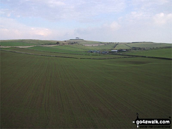
Walking and Hiking Photo:
View from the High Peak Trail
The White Peak Area,
The Peak District National Park,
Derbyshire, England
The White Peak Area,
The Peak District National Park,
Derbyshire, England
   |
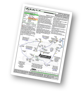
Vital Statistics:
| Length: | 5 miles (8 km) |
| Ascent: | 433ft (132m) |
| Time: | 2 hrs |
| Grade: |  |
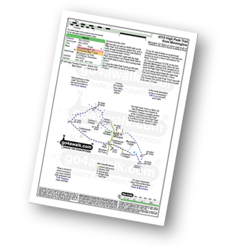
Route Summary:
Minninglow - The High Peak Trail - Green Lane - Cobblersnook Lane - Minninglow Lane - The High Peak Trail - Minninglow
|
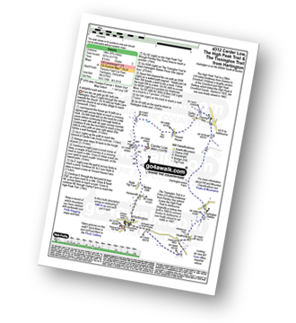
Vital Statistics:
| Length: | 6 miles (9.5 km) |
| Ascent: | 565ft (172m) |
| Time: | 2.75hrs |
| Grade: |  |
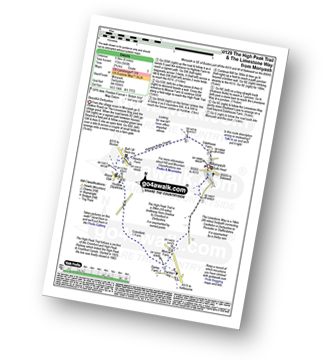
Route Summary:
Monyash - Moscar Farm - The High Peak Trail - Parsley Hay - Hardlow - Sparklow - Bull I' Th' Thorn Inn - Newton Farm - Hutmoor Butts - The Limestone Way - Dalehouse Farm - Monyash
|
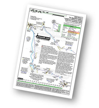
Vital Statistics:
| Length: | 10.5 miles (16.5 km) |
| Ascent: | 1,287ft (392m) |
| Time: | 5 hrs |
| Grade: |  |
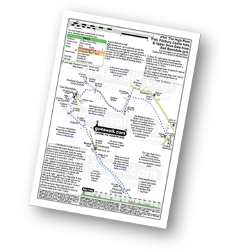
Route Summary:
Earl Sterndale - Hindlow Quarry - Dowlow Works - The Midshires Way - The High Peak Trail - Pomeroy - Hurdlow - Parsley Hay - Darley Farm - Vincent House - Pilsbury - Pilsbury Castle Hills - Upper Dove Dale - Bridge End Farm - Crowdecote - Meadow Farm - Underhill Farm - Hitter Hill - Earl Sterndale
|
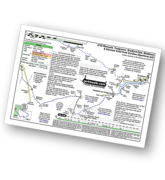
Vital Statistics:
| Length: | 9.75 miles (15.5 km) |
| Ascent: | 1,240ft (378m) |
| Time: | 4.75hrs |
| Grade: | |
Route Summary:
Middleton-by-Youlgreave - River Bradford - Rusden Wood - Gratton Moor - Long Dale - Bolderstone Plantation - Friden Station - The High Peak Trail - Green Lane (Friden) - Mere Farm - Ringham Low (Friden) - Kenslow Farm - Kenslow Knoll - Little Rockery Plantation - Rake Wood - Middleton-by-Youlgreave
|
Vital Statistics:
| Length: | 8.75 miles (14 km) |
| Ascent: | 1,171ft (357m) |
| Time: | 4½ hrs |
| Grade: | |
Route Summary:
Hartington - Gorsecroft - Madge Dale - Bank Top Farm - Carder Low - Vincent House - Darley Farm - The High Peak Trail - Parsley Hay - The Tissington Trail - Hartington Station - Heathcote - Heathcote Mere - Highfield Lane - Hartington
|
Vital Statistics:
| Length: | 13.5 miles (21.5 km) |
| Ascent: | 1,286ft (392m) |
| Time: | 6.25hrs |
| Grade: |  |
Route Summary:
Hartington - Sheen - Brund - Manifold Valley - Longnor - Crowdecote (Crowdicote) - Bridge End Farm - Upper Dove Dale - Pilsbury Castle Hills - Vincent House - Darley Farm - The High Peak Trail - Parlsey Hay - The Tissington Trail - Hartington Station - Heathcote - Heathcote Mere - Highfield Lane - Hartington
|
Vital Statistics:
| Length: | 15 miles (24 km) |
| Ascent: | 1,831ft (558m) |
| Time: | 7.25hrs |
| Grade: |  |
Route Summary:
Hurdlow - Sparklow - The High Peak Trail - Hutmoor Butts - The Limestone Way - Monyash - One Ash Grange Farm - Calling Low Farm - Cales Dale - Moor Lane - Youlgreave - Lomberdale Hall - Middleton-by-Youlgreave - Rake Wood - Little Rookery Plantation - Kenslow Farm - Kenslow Knoll - Ringham Low (Friden) - Mere Farm - Green Lane (Friden) - The High Peak Trail - Sparklow - Hurdlow
Send us your photographs and pictures of walks and hikes in the British countryside
If you would like to see your digital photographs as part of this collection, please send them as email attachments (configured for any computer) along with your name to:
and we shall do our best to publish them.
(Guide Resolution = 300dpi. At least = 587 pixels (wide) x 440 pixels (high).)

You can also submit photos via our Facebook Page.
NB. Please indicate where each photo was taken.
NB. To see photographs and pictures from a particular walk choose your walk from Walks or use our Walk Search facility.
To see photographs and pictures on, of or from a particular Mountain, Peak, Top or Hill select from Peaks & Mountains' or enter the Mountain, Peak, Top or Hill Name into our 'Photo Search facility.

To contribute to go4awalk.com or to contact us about anything at all - see Talk To Us. For help see Help.
go4awalk.com and go4awalk.co.uk are registered trademarks of TMDH Limited.
Copyright © 2000-2024 TMDH Limited. All rights reserved.
Copyright | Terms & Conditions | Privacy Statement
A - Z
Walks
Home
Log On/Accounts
Photo Gallery
Walk Ideas and Collections
Fell Facts
Places to Stay
Hill Skills
Walking Questions and Answers
Your Stories
News
Competitions
Product Reviews/Gear Tests
Walking Gear Guides
Peaks and Mountains
Peak Bagging
Find New Walking Friends
Camping
GPS Waypoints for Walking
Walk Search
Talk to us
go4awalk.com Help
Free example walks
Newsletter


