
![]()
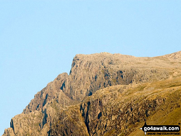
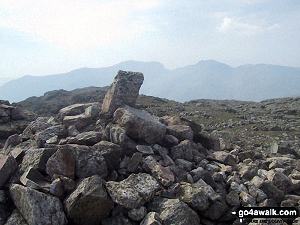
Symonds Knott
959m (3147ft)
The Southern Fells, The Lake District, Cumbria, England
You can find Symonds Knott & all the walks that climb it on these unique free-to-access Interactive Walk Planning Maps: (click/TAP to select)
1:25,000 scale OS Explorer Map (the ones with orange/yellow covers):
1:50,000 scale OS Landranger Maps (the ones with pink/magenta covers):
See Symonds Knott and the surrounding tops on our free-to-access 'Google Style' Peak Bagging Maps:
See Symonds Knott and the surrounding tops on our downloadable PDF Peak Bagging Maps:
*Walk & bag all 30 Wainwrights in The Southern Fells area of The Lake District in just 11 easy-to-follow circular walks.
*This version is marked with the walk routes you need to follow to Walk all 214 Wainwrights in just 59 walks. Click here for more information.
NB: Whether you print off a copy on to paper or download it to your phone, these PDF Peak Baggers Maps will prove incredibly useful when your are up there on the tops and you cannot get a phone signal!
   |
|---|
Vital Statistics:
| Length: | 7.5ml (12km) |
|---|---|
| Ascent: | 4,195ft (1,279m) |
| Time: | 7 hrs |
| Grade: |  (Hard) (Hard) |
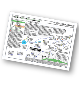
Route Summary:
Wasdale Head - (National Trust Campsite) - Wast Water - Lingmell - Corridor Route - Scafell Pike - Mickledore - Foxes Tarn - Symonds Knott - Sca Fell - Lingmell Gill - Wasdale Head - Wast Water.
|
|---|
Vital Statistics:
| Length: | 10ml (16km) |
|---|---|
| Ascent: | 3,428ft (1,045m) |
| Time: | 7 hrs |
| Grade: | (Hard) |
Route Summary:
Eskdale - Wha House Farm - Hare Crag - Quagrigg Moss - Slight Side - Sca Fell - Symonds Knott - Foxes Tarn - Cam Spout Crag - River Esk - Great Moss - Lingcove Bridge - Brotherilkeld - Hardknott Pass - Eskdale
|
|---|
Vital Statistics:
| Length: | 10ml (16km) |
|---|---|
| Ascent: | 3,401ft (1,037m) |
| Time: | 7 hrs |
| Grade: | (Hard) |
Route Summary:
Eskdale - Wha House Farm - Hare Crag - Goat Crag - Dawsonground Crags - Cat Crag - Quagrigg Moss - Slight Side - Sca Fell - Symonds Knott - Hard Rigg - Burnmoor Tarn - Eel Tarn - Christcliff - Wha House Farm - Eskdale
|
|---|
Vital Statistics:
| Length: | 9.75ml (15.5km) |
|---|---|
| Ascent: | 5,140ft (1,567m) |
| Time: | 8.75hrs |
| Grade: |  (Hard) (Hard) |
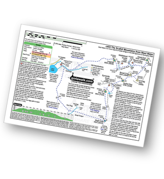
Route Summary:
Wasdale Head - (National Trust Campsite) - Wast Water - Lingmell - Middleboot Knotts - Round How (Scafell) - Great End - Ill Crag - Broad Crag - Scafell Pike - Mickledore - Foxes Tarn - Symonds Knott - Sca Fell - Wast Water.
|
|---|
Vital Statistics:
| Length: | 11ml (17.5km) |
|---|---|
| Ascent: | 5,409ft (1,648m) |
| Time: | 9½ hrs |
| Grade: | (Hard) |
Route Summary:
Wasdale Head - (National Trust Campsite) - Wast Water - Lingmell - Corridor Route - Great End - Ill Crag - Broad Crag - Scafell Pike - Mickledore - Foxes Tarn - Symonds Knott - Sca Fell - Slight Side - Broad Tongue - Hardrigg Gill - Wasdale Head - Wast Water.
|
|---|
Vital Statistics:
| Length: | 13.75ml (22km) |
|---|---|
| Ascent: | 4,982ft (1,519m) |
| Time: | 10 hrs |
| Grade: |  (Very Hard) (Very Hard) |

Route Summary:
Eskdale - Wha House Farm - Hare Crag - Quagrigg Moss - Slight Side - Sca Fell - Symonds Knott - Scafell Pike - Broad Crag - Ill Crag - Great End - Esk Hause - Lingcove Bridge - Great Moss - Eskdale
|
|---|
Vital Statistics:
| Length: | 14ml (22.5km) |
|---|---|
| Ascent: | 6,009ft (1,832m) |
| Time: | 9 hrs |
| Grade: | (Very Hard) |
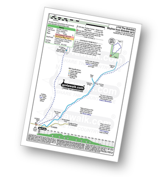
Route Summary:
Eskdale - Wha House Farm - Hare Crag - Quagrigg Moss - Slight Side - Sca Fell - Symonds Knott - Mickledore - Scafell Pike - Broad Crag - Ill Crag - Great End - Esk Hause - Esk Pike - Ore Gap - Bow Fell (Bowfell) (North Top) - Bow Fell (Bowfell) - Bowfell Buttress - Cambridge Crag - Flat Crag - Climbers' Traverse (optional) - Three Tarns - Great Moss - Brotherikeld - Eskdale
 Fellow go4awalkers who have already walked, climbed, summited & bagged Symonds Knott
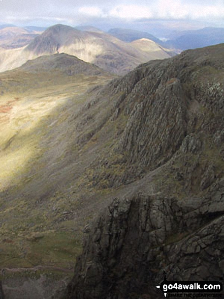
Kevin Foster walked up Symonds Knott on May 19th, 2022 [from/via/route] National Trust car park, Brackenclose, Wasdale Head. [with] By myself. [weather] Early cloud on Scafells lifting by midday then sunny. - After the summit I crossed the flat col to the subsidiary peak of Symond's Knot which sits right above the steep northern Craggs of Scafell. I took a peak over but didn't get too near the edge. Nine tops in all bagged today & all the southern fells done. Exhausted but happy.
Simon Myerscough climbed Symonds Knott on April 18th, 2006 [from/via/route] C271 [weather] Cloudy first, sunny later, Very very windy (hailstones)
Mark Davidson bagged Symonds Knott on November 9th, 2002 [with] Anne S, Sally, Tony & the gang etc [weather] Clear for November
Tony Rogerson hiked Symonds Knott on June 23rd, 2011 [from/via/route] Eskdale Symonds Knott Sca Fell & Slight Side [weather] Low cloud
Darren Mortimer summited Symonds Knott on April 4th, 2015 [from/via/route] Eskdale [with] Dermot Palmer [weather] Warm & sunny
Andrew Joss conquered Symonds Knott on June 8th, 2013 [from/via/route] Wasdale Head NT car park [with] Mick [weather] Warm with sun & clouds - Nice view towards Scafell Pike
Ray O'hara scaled Symonds Knott on June 13th, 2011 [from/via/route] Wasdale Head, Slight Side, Scafell, Symonds Knott, Illgill Head, Whin Rigg [weather] Clear & dry, below the cloud base - Very nice walk
Christine Shepherd walked up Symonds Knott on August 16th, 2005 [from/via/route] Wasdale Head [with] On my own [weather] Hazy & humid
Patrick Rogozinski, Leon Potts, Louise Sandwith, Craig Lewis and Adrian Roberts have all walked, climbed & bagged Symonds Knott.
To add (or remove) your name and experiences on this page - Log On and edit your Personal Mountain Bagging Record
More Photographs & Pictures of views from, on or of Symonds Knott
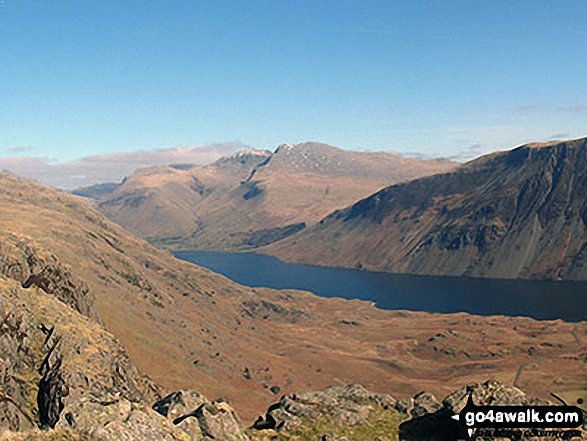
The Scafel Massive featuring Ling Mell, Great End, Broad Crag, Ill Crag, Scafell Pike, Symonds Knott and Sca Fell above Wast Water from Buckbarrow
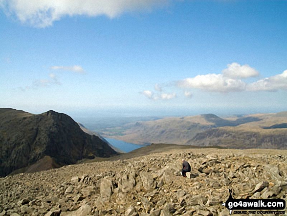
Lone fell walker on Scafell Pike with Symonds Knott and Sca Fell (left), Wast Water and Seatallen (right) beyond
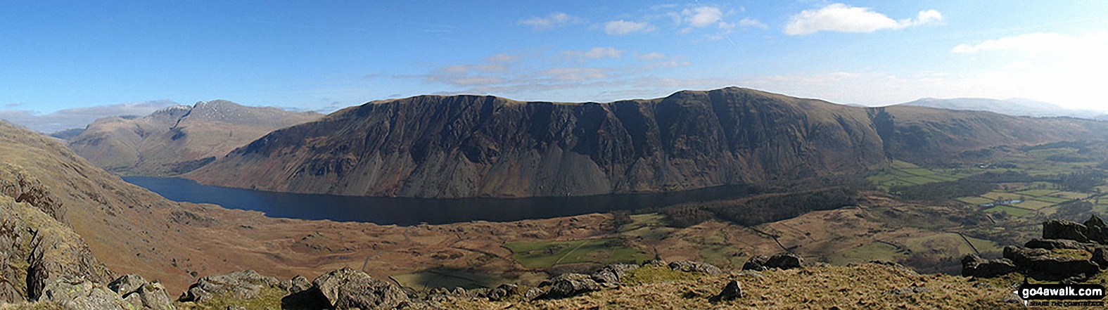
Wast Water with the Scafel Massive (far left- featuring Ling Mell, Great End, Broad Crag, Ill Crag, Scafell Pike, Symonds Knott and Sca Fell) and Illgill Head (centre) and Whin Rigg (centre right) above the Wast Water screes from Buckbarrow
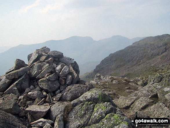
The Scafell Massif - Slight Side, Sca Fell, Symonds Knott, Mickledore, Scafell Pike, Ill Crag and Great End - from the summit cairn on Crinkle Crags (South Top)
The Scafell Massif - Sca Fell, Symonds Knott, Mickledore, Scafell Pike, Ill Crag & Great End - with Bow Fell (Bowfell) in the right foreground from the summit of Bow Fell (Bowfell) (North Top)
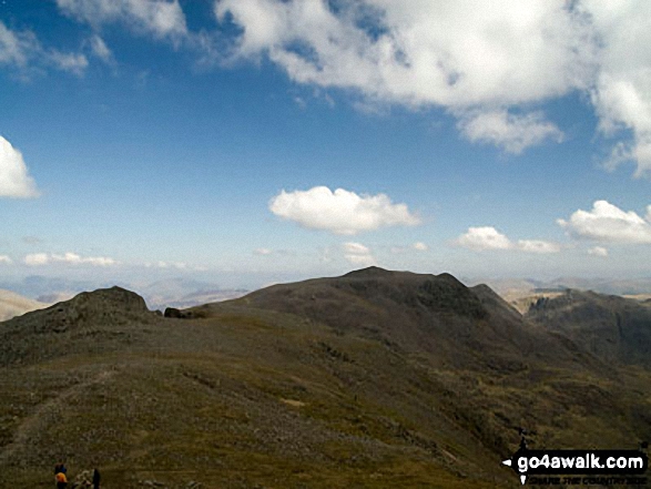
The Scafell Massif - Slight Side, Sca Fell, Symonds Knott, Mickledore, Scafell Pike and Ill Crag - from the summit of Bow Fell (Bowfell)
The Scafell Massif - Slight Side, Sca Fell, Symonds Knott, Mickledore, Scafell Pike, Ill Crag and Great End - from the summit of Little Stand
The Scafell Massif - Slight Side, Sca Fell, Symonds Knott, Mickledore, Scafell Pike, Ill Crag and Great End from Crinkle Crags (Long Top)
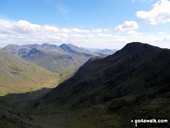
Looking down Mosedale to Wasdale Head from Little Scoat Fell with Red Pike (Wasdale) on the right in shadow and the Scafell Massif (featuring Great End, Broad Crag, Lingmell, Scafell Pike, Symonds Knott and Sca Fell) across the valley
Send us your photographs and pictures on, of, or from Symonds Knott
If you would like to add your walk photographs and pictures featuring views from, on or of Symonds Knott to this page, please send them as email attachments (configured for any computer) along with your name to:
and we shall do our best to publish them.
(Guide Resolution = 300dpi. At least = 660pixels (wide) x 440 pixels (high).)

You can also submit photos via our Facebook Page.
NB. Please indicate where each photo was taken.


