
![]()
Murton Fell
673m (2210ft)
The North Pennines, Cumbria, England
You can find Murton Fell & all the walks that climb it on these unique free-to-access Interactive Walk Planning Maps: (click/TAP to select)
1:25,000 scale OS Explorer Map (the ones with orange/yellow covers):
1:50,000 scale OS Landranger Map (the ones with pink/magenta covers):
Murton Fell on our free-to-access 'Google Style' Peak Bagging Map:
See Murton Fell and the surrounding tops on our downloadable PDF Peak Bagging Map:
   |
|---|
Vital Statistics:
| Length: | 10.75ml (17km) |
|---|---|
| Ascent: | 1,976ft (602m) |
| Time: | 6 hrs |
| Grade: |  (Moderate) (Moderate) |
Route Summary:
Dufton - The Pennine Way - Town End - Kemplar Bridge - Greenhow Farm - Keisley House - Harbour Flatt Farm - Trundale Gill - Middle Tongue - Murton Fell - Murton Herds - High Cup - High Cup Gill - High Cup Nick - The Pennine Way - Narrow Gate Path - Peeping Hill - Bow Hall - Town Head - Dufton
|
|---|
Vital Statistics:
| Length: | 15.75ml (25km) |
|---|---|
| Ascent: | 2,918ft (889m) |
| Time: | 8.75hrs |
| Grade: |  (Hard) (Hard) |
Route Summary:
Hilton Town Head - Hilton Beck - Warcop Training Area - Swindale Brow - Swindale Beck - Swindale Edge - Marn Gill - Christy Bank - Siss Gill - Burton Fell - Little Fell (Burton Fell) - Hilton Fell - Arnside Rake - King's Pot - Mickle Fell - Fisher Sike - Maize Beck - Swarth Beck - Master Sike - Murton Fell - Murton Fell (SE Top) - Scordale - Lowfield Hush - Hilton Town Head
 Fellow go4awalkers who have already walked, climbed, summited & bagged Murton Fell
Caroline Winter walked up Murton Fell on August 25th, 2021 [from/via/route] Dufton, Murton Fell, High Cup Nick, return along U valley [with] Becky [weather] Warm - Took some time to locate top. Paced from water south & found amongst bog
Kevin Foster climbed Murton Fell on August 5th, 2017 [from/via/route] Linear route (two cars) from lay-by on B6276 near Grains of the Beck, Lunedale valley to Murton village (car park at north end of village), Eden valley Cumbria [with] Me and Bruce [weather] Sunny, with heavy showers until late afternoon then just sunny. - What can I say about Murton Fell? The top of the fell is very flat & extremely boggy in places & the actual 'summit' itself was difficult to locate. My mate Bruce didn't enjoy it & actually questioned my sanity. He probably had a point. We took a pathless more or less direct line route off Little Fell to the head of the Scordale valley. The views were great but the distinct path marked on the OS map running up the valley & over the pass was non-existent. From here we ascended directly up the fell side following what I assumed were tank tracks to the table flat summit. Unfortunately we were southeast of the actual summit cairn by some way. Using the map to take a grid reference, I used my OS locate app on my phone to pinpoint first the tarn & then the tiny summit cairn to the northeast of the tarn but unfortunately this meant walking over over some very rough ground indeed. I can't honestly say that clambering through peat hags was that enjoyable but we made it to the tarn & then the summit eventually. In complete contrast, the descent off Murton Fell via Burnt Crags & then on a delightful track contouring the side of Murton Pike back to Murton village was delightful with stunning views South throughout. I haven't been put off 'doing the Nuttalls' but now realise what a tough challenge I've let myself in for. I would love to come back one day to reverse the walk up the side of Murton Fell to High Cup Nick & come back via High Cup Gill. The top of the fell is best avoided though unless you have to bag it.
Mark Davidson bagged Murton Fell on November 12th, 2008 [with] Mike [weather] Lovely & sunny for November - First 'wild camp' in the van
Chris Faulkner hiked Murton Fell on April 3rd, 2016 [from/via/route] Hilton via Scoredale Gorge [with] Chelle [weather] Fine - At Last !!
Darren Mortimer summited Murton Fell on March 20th, 2016 [from/via/route] Dufton [with] Dermot Palmer [weather] Sunny
Christine Shepherd conquered Murton Fell on August 2nd, 2013 [from/via/route] Walked from Dufton using walk c438 [with] On my own [weather] Fine but a bit overcast. Very windy on High Cup Nick. - The summit of Murton Fell isn't easy to find. The 'walk across the grass' is actually across peat bogs, & ankle turning terrain. A great walk over High cup Nick with amazing views does make up for it though.
Ray O'hara scaled Murton Fell on June 26th, 2013 [from/via/route] tagged onto C419 [weather] fine & warm - It was a bit boggy on the top, but I've known worse. Nice views across to Mickle Fell & Little Fell
Patrick Rogozinski and Matthew Thomas have both walked, climbed & bagged Murton Fell.
To add (or remove) your name and experiences on this page - Log On and edit your Personal Mountain Bagging Record
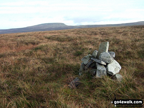
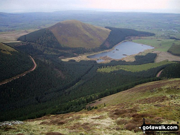
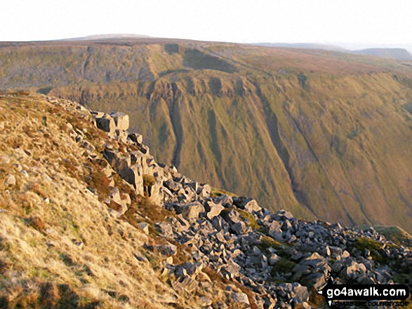
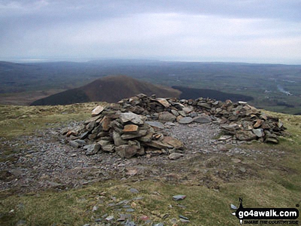
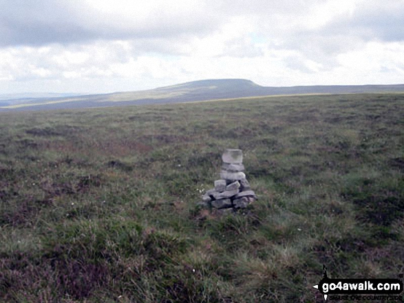
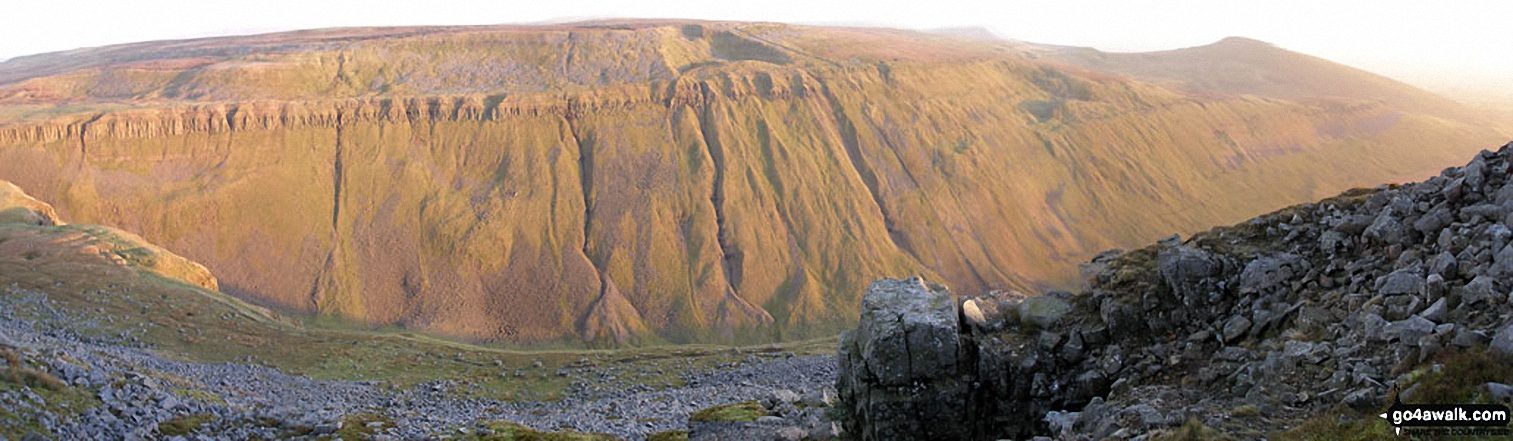
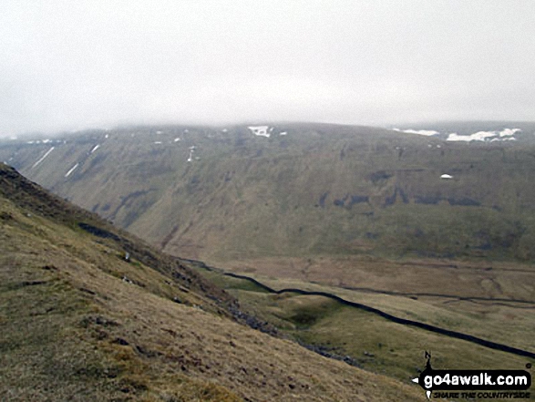
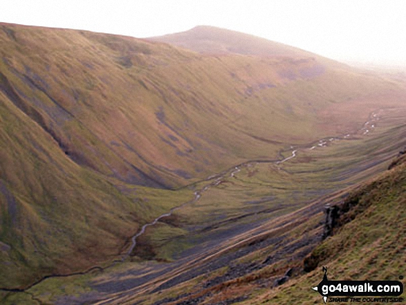
More Photographs & Pictures of views from, on or of Murton Fell
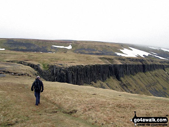
Approaching High Cup Gill above High Cup Nick, High Cup with Murton Fell beyond
Send us your photographs and pictures on, of, or from Murton Fell
If you would like to add your walk photographs and pictures featuring views from, on or of Murton Fell to this page, please send them as email attachments (configured for any computer) along with your name to:
and we shall do our best to publish them.
(Guide Resolution = 300dpi. At least = 660pixels (wide) x 440 pixels (high).)

You can also submit photos via our Facebook Page.
NB. Please indicate where each photo was taken.


