
![]()
Hart Crag
822m (2698ft)
The Eastern Fells, The Lake District, Cumbria, England
You can find Hart Crag & all the walks that climb it on these unique free-to-access Interactive Walk Planning Maps: (click/TAP to select)
1:25,000 scale OS Explorer Map (the ones with orange/yellow covers):
1:50,000 scale OS Landranger Map (the ones with pink/magenta covers):
See Hart Crag and the surrounding tops on our free-to-access 'Google Style' Peak Bagging Maps:
See Hart Crag and the surrounding tops on our downloadable PDF Peak Bagging Maps:
*Walk & bag all 35 Wainwrights in The Eastern Fells area of The Lake District in just 8 easy-to-follow circular walks.
*This version is marked with the walk routes you need to follow to Walk all 214 Wainwrights in just 59 walks. Click here for more information.
NB: Whether you print off a copy on to paper or download it to your phone, these PDF Peak Baggers Maps will prove incredibly useful when your are up there on the tops and you cannot get a phone signal!
   |
|---|
Vital Statistics:
| Length: | 7.75ml (12.5km) |
|---|---|
| Ascent: | 2,800ft (853m) |
| Time: | 5.75hrs |
| Grade: |  (Moderate) (Moderate) |
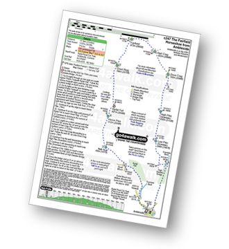
Route Summary:
Cow Bridge Car Park - Brothers Water - Hartsop Hall - Kirkstone Beck - High Hartsop Dodd - Little Hart Crag - Dove Crag - Hart Crag - Blake Brow - Hartsop Above How - Hoggill Brow - Gale Crag - Bleaberry Knott - Cockley How - Cow Bridge
|
|---|
Vital Statistics:
| Length: | 9.75ml (15.5km) |
|---|---|
| Ascent: | 3,516ft (1,072m) |
| Time: | 7 hrs |
| Grade: |  (Hard) (Hard) |
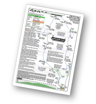
Route Summary:
Patterdale - Arnison Crag - Birks - St Sunday Crag - Deepdale Hause - Cofa Pike - Fairfield - Rydal Head - Hart Crag - Blake Brow - Hartsop Above How - Hoggill Brow - Gale Crag - Bleaberry Knott - Cockley How - Bridgend - Patterdale
|
|---|
Vital Statistics:
| Length: | 9.75ml (15.5km) |
|---|---|
| Ascent: | 3,699ft (1,127m) |
| Time: | 7.25hrs |
| Grade: | (Hard) |
Route Summary:
Cow Bridge Car Park - Brothers Water - Hartsop Hall - Kirkstone Beck - Caiston Beck - Middle Dodd - Red Screes - Scandale Pass - Little Hart Crag - Dove Crag - Hart Crag - Blake Brow - Hartsop Above How - Hoggill Brow - Gale Crag - Bleaberry Knott - Cockley How - Cow Bridge
|
|---|
Vital Statistics:
| Length: | 11ml (17.5km) |
|---|---|
| Ascent: | 3,633ft (1,107m) |
| Time: | 7.75hrs |
| Grade: | (Hard) |
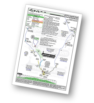
Route Summary:
Ambleside - Rydal - Nab Scar - Heron Pike - Rydal Fell (Heron Pike North Top) - Great Rigg - Fairfield - Rydal Head - Hart Crag - Dove Crag - High Pike (Scandale) - Low Pike (Scandale) - High Sweden Bridge - High Sweden Coppice - Ambleside
|
|---|
Vital Statistics:
| Length: | 12.25ml (19.5km) |
|---|---|
| Ascent: | 3,984ft (1,214m) |
| Time: | 8½ hrs |
| Grade: |  (Hard) (Hard) |
Route Summary:
Ambleside - Rydal - Nab Scar - Heron Pike - Rydal Fell (Heron Pike North Top) - Greenhead Gill Head - Stone Arthur - Great Rigg - Fairfield - Rydal Head - Hart Crag - Dove Crag - High Pike (Scandale) - Low Pike (Scandale) - High Sweden Bridge - High Sweden Coppice - Ambleside
|
|---|
Vital Statistics:
| Length: | 12.5ml (20km) |
|---|---|
| Ascent: | 3,411ft (1,040m) |
| Time: | 8 hrs |
| Grade: | (Hard) |
Route Summary:
Ambleside - Rydal - Nab Scar - Heron Pike - Rydal Fell (Heron Pike North Top) - Great Rigg - Fairfield - Rydal Head - Hart Crag - Dove Crag - Little Hart Crag - Scandale Pass - Red Screes - Snarker Pike - Ambleside
|
|---|
Vital Statistics:
| Length: | 13.75ml (22km) |
|---|---|
| Ascent: | 5,501ft (1,676m) |
| Time: | 10½ hrs |
| Grade: |  (Very Hard) (Very Hard) |
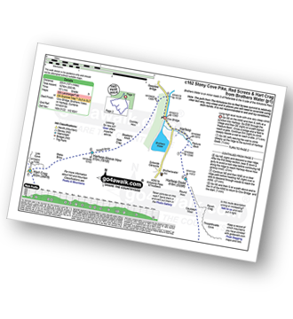
Route Summary:
Cow Bridge Car Park - Brothers Water - Hartsop - Hartsop Dodd - Caudale Moor - Stony Cove Pike (Caudale Moor) - Caudale Head - Pike How - St Raven's Edge - The Kirkstone Pass - Red Screes - Smallthwaite Band - Middle Dodd - Scandale Pass - Little Hart Crag - High Hartsop Dodd - Little Hart Crag - Scandale Head - Dove Crag - Hart Crag - Blake Brow - Hartsop Above How - Hoggill Brow - Gale Crag - Bleaberry Knott - Cockley How - Cow Bridge
 Fellow go4awalkers who have already walked, climbed, summited & bagged Hart Crag
Melfyn Parry walked up Hart Crag on November 21st, 2023 [from/via/route] Followed route C247 - walked out of Ambleside on the A591 & just after Scandale Bridge we crossed the road to follow the lane into the Rydal Hall estate, went passed the cafe & the Hall & then turned right to pass Rydal Mount. Here we veered left to take the stone steps path to the top of Nab Scar, again following a well defined path we were soon on Heron Pike. Continuing along the path with a slight detour to ascend Heron Pike north top. Continuing on to Great Rigg & onwards to Fairfield. We stopped here for lunch & the clouds lifted to give great views over towards Helvellyn & Sunday Crag. After pausing to take some photos we retraced our steps for a few metres before heading left to follow the ridge line to ascend Hart Crag, then Dove Crag & then High Pike. The undulating ridge takes you through some quite boggy areas & on to Low Pike & then down to High Sweden Bridge (a fascinating old bridge). All that was left to do from here was to follow the trail downwards in to Ambleside returning to the village by the Salutation Hotel. [with] DS [weather] Visibility was very good below 800m. By lunchtime the cloud had lifted even more to give clear views of the whole horseshoe. A dry day with sunny intervals, quite cold above 600m but very pleasant below this level. - Doing the walk in a clockwise direction as per C247 is best as the ascent anticlockwise would be much more of a cardio vascular workout.
David Higginbottom climbed Hart Crag on February 8th, 2023 [from/via/route] Route 247 [with] Carolyn [weather] Very poor
Rob Prikanowski bagged Hart Crag on June 21st, 2023 [from/via/route] c247 [weather] Cloudy but dry, strong wind, top in the mist.
Ian Ashton hiked Hart Crag on February 25th, 2023 [with] With jph
Angeline Grieveson summited Hart Crag on February 19th, 2023 [with] Dotty
Sarah Moore conquered Hart Crag on December 5th, 2022 [from/via/route] c247 / The Fairfield Horseshoe (from Ambleside) [with] On my own [weather] Beautiful start with a cold edge... turning to icy cold with sleet & minimal visibility between Great Rigg - Fairfield - Hart Crag. - This one scared me. The realisation that if I slipped up at Fairfield then I don't know that I could have waited an hour plus for mountain rescue was very scary. Used the GPS & was proud of myself but major "eeek"
Martyn Atherton scaled Hart Crag on September 18th, 2022 [from/via/route] C235 Arniston Crag, Birks, St Sunday Crag, Fairfield, Hart Crag & Hartsop Above How [with] Paul Atherton [weather] Misty, rain & Sunny - Loved the route 6 hrs 50 minutes
Mr Davison walked up Hart Crag on November 18th, 2017 [from/via/route] Fairfield horseshoe [with] Ian F, Ian F, Mike, Gary, Simon, Martyn, Andy [weather] sunny,
Christine Shepherd climbed Hart Crag during October, 1998 [from/via/route] Cow Bridge near Brother's water Did the Fairfield Horseshoe for the fifth time on 19.6.22 [with] My friend Miriam [weather] Bight & fresh. Perfect walking weather - I have climbed Hart crag again in May 07 & on 26.3.12 & 25.3.18 as part of the Fairfield Horseshoe(walk c247) & in deep snow on 1.3.10 while doing the Dovedale round using walk c333 Bagged again doing The Dovedale Round anti clockwise 10.07.2021
Shirley Philips has bagged Hart Crag [from/via/route] Fairfield Horseshoe from Ambleside
To add (or remove) your name and experiences on this page - Log On and edit your Personal Mountain Bagging Record
. . . [see more walk reports]
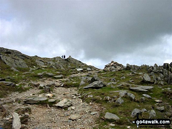
More Photographs & Pictures of views from, on or of Hart Crag
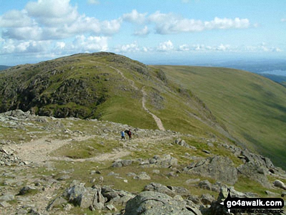
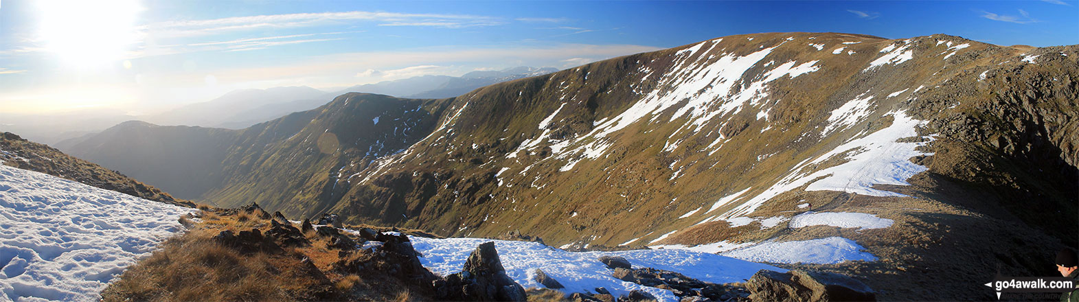
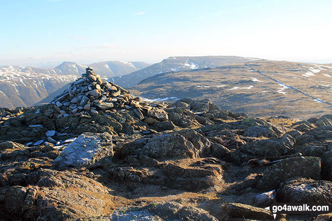
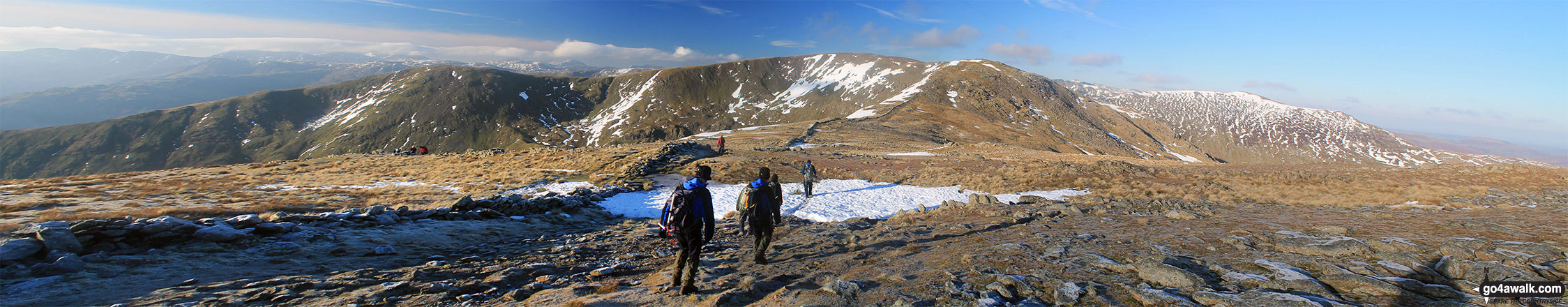
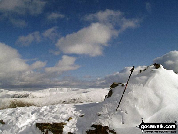
Heron Pike, Heron Pike (North Top), Great Rigg, Rydal Head and Fairfield from Hart Crag
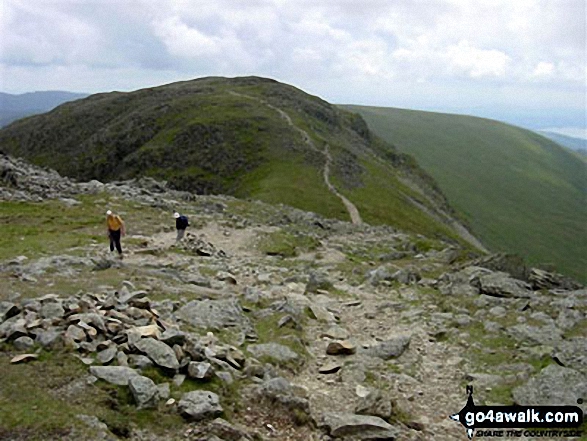
Rydal Water (left) and Coniston Water (right - far distance) and Heron Pike in mid-distance from Hart Crag
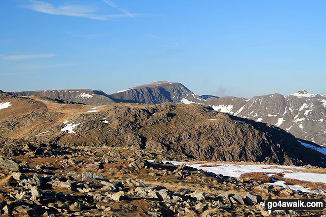
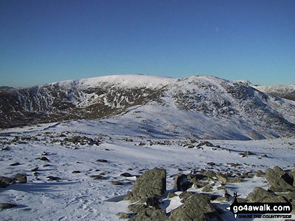
Rydal Head with Fairfield (left) and Hart Crag (right) from Great Rigg
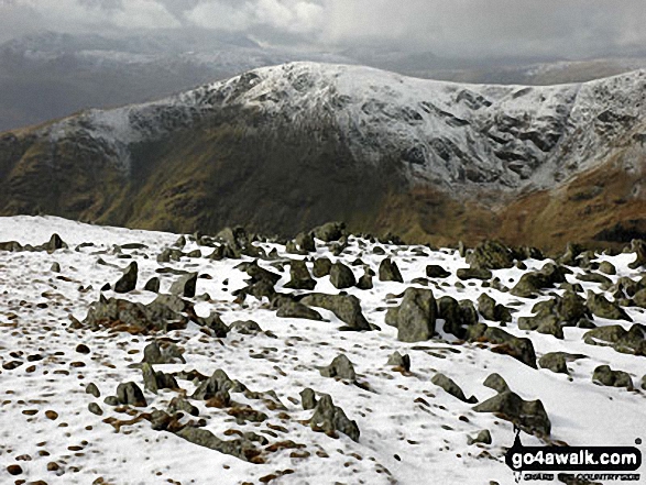
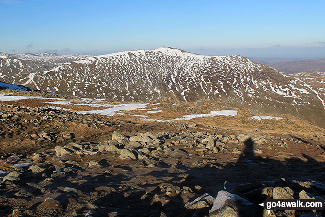
Looking East to the snowy fell tops of Stony Cove Pike (Caudale Moor) and High Street from the summit of Little Hart Crag
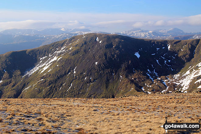
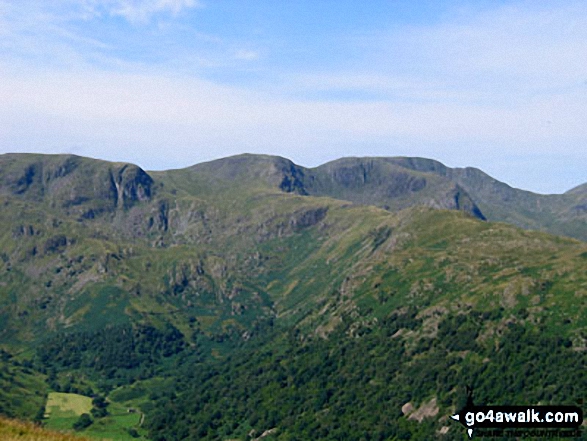
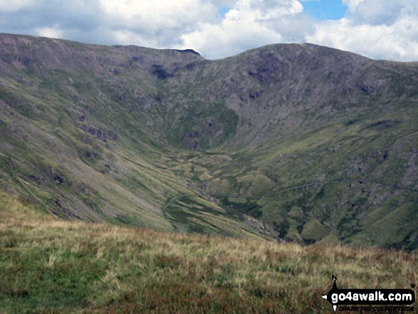
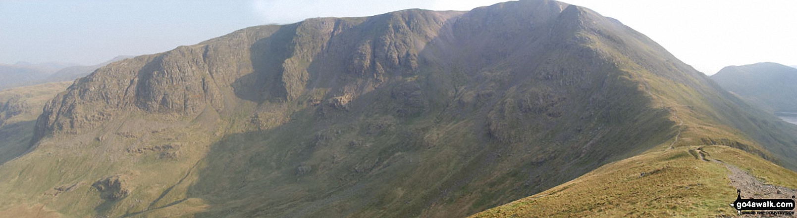
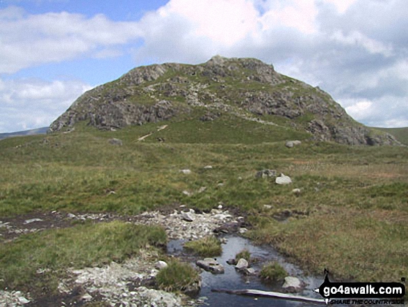
Dove Crag, Hart Crag and Fairfield dominate the skyline beyond Brothers Water
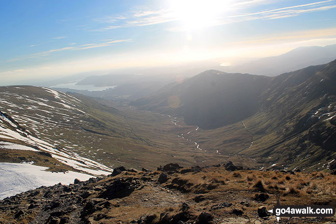
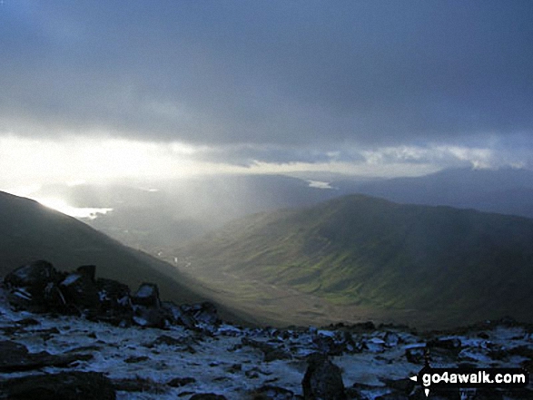
Lake Windermere and Rydal Valley from Rydal Head with Heron Pike on the right
. . . see all 24 walk photographs & pictures of views from, on or of Hart Crag
Send us your photographs and pictures on, of, or from Hart Crag
If you would like to add your walk photographs and pictures featuring views from, on or of Hart Crag to this page, please send them as email attachments (configured for any computer) along with your name to:
and we shall do our best to publish them.
(Guide Resolution = 300dpi. At least = 660pixels (wide) x 440 pixels (high).)

You can also submit photos via our Facebook Page.
NB. Please indicate where each photo was taken.


