
![]()
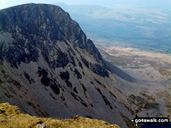
Cyfrwy
811m (2662ft)
The Cadair Idris Area, Snowdonia, Gwynedd, Wales
You can find Cyfrwy & all the walks that climb it on these unique free-to-access Interactive Walk Planning Maps: (click/TAP to select)
1:25,000 scale OS Explorer Map (the ones with orange/yellow covers):
1:50,000 scale OS Landranger Map (the ones with pink/magenta covers):
See Cyfrwy and the surrounding tops on our free-to-access 'Google Style' Peak Bagging Maps:
See Cyfrwy and the surrounding tops on our downloadable PDF Peak Bagging Map:
   |
|---|
Vital Statistics:
| Length: | 6ml (9.5km) |
|---|---|
| Ascent: | 2,609ft (975m) |
| Time: | 5 hrs |
| Grade: |  (Moderate) (Moderate) |
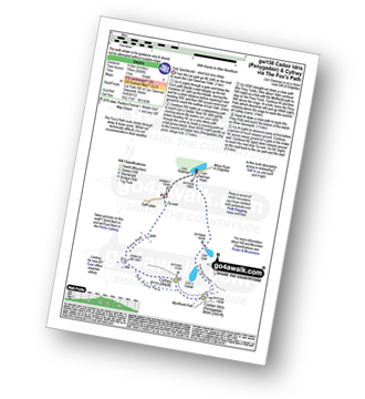
Route Summary:
Llyn Gwernan - Llyn Gafr - Llyn y Cadair - The Fox's Path - Cadair Idris (Penygadair) - The Pony Path - Cyfrwy - Rhiw Gwerdydd - Llyn Gwernan
|
|---|
Vital Statistics:
| Length: | 10.5ml (17km) |
|---|---|
| Ascent: | 3,627ft (1,105m) |
| Time: | 7½ hrs |
| Grade: |  (Hard) (Hard) |
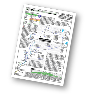
Route Summary:
Llanfihangel-y-pennant - Afon Cadair - Tynyfach - Gwastadfryn - Hafotty Gwastaffryn - Rhiw Gwerdydd - The Pony Path - Cyfrwy - Cadair Idris (Penygadair) - Craig Cau - Craig Cwm Amarch - Mynydd Pencoed - Pencoed - Llanfihangel-y-pennant
|
|---|
Vital Statistics:
| Length: | 11.25ml (18.5km) |
|---|---|
| Ascent: | 3,558ft (1,084m) |
| Time: | 7.75hrs |
| Grade: | (Hard) |
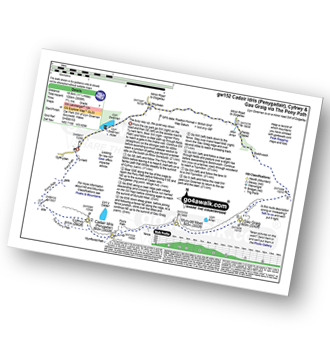
Route Summary:
Llyn Gwernan - The Pony Path - Rhiw Gwerdydd - Cyfrwy - Cadair Idris (Penygadair) - Mynydd Moel - Gau Graig - Bwlch-coch - Pandy Gader - Afon Arran - Rhydwen - Llyn Gwernan
|
|---|
Vital Statistics:
| Length: | 9.75ml (15.5km) |
|---|---|
| Ascent: | 4,247ft (1,294m) |
| Time: | 7.75hrs |
| Grade: |  (Hard) (Hard) |
Route Summary:
Llyn Gwernan - Llyn Gafr - The Fox's Path - Cadair Idris (Penygadair) - Mynydd Moel - Craig Cwm Amarch - Craig Cau - The Pony Path - Cyfrwy - Rhiw Gwerdydd - Llyn Gwernan
|
|---|
Vital Statistics:
| Length: | 10.5ml (17km) |
|---|---|
| Ascent: | 4,060ft (1,237m) |
| Time: | 8 hrs |
| Grade: | (Hard) |
Route Summary:
Minffordd Hotel - Afon Faw - Ystrad-gwyn - Nant Cadair - The Minffordd Path - Llyn Cau - Craig Lwyd - Craig Cwm Amarch - Craig Cau - Cadair Idris (Penygadair) - Cyfrwy - Cadair Idris (Penygadair) - Mynydd Moel - Gau Graig - Mynydd Gwerngraig - A487 - Nant Yr Allt-ioen - Cwm Rhwyddfor - Bwlch Llyn Bach - Minffordd.
 Fellow go4awalkers who have already walked, climbed, summited & bagged Cyfrwy
Melfyn Parry walked up Cyfrwy on October 13th, 2022 [from/via/route] Started walk from car park at SH732115 & followed well signposted path over the river & past the visitor centre before ascending through woodland up steep stone steps. Path continues steeply upwards & then forks to the right at SH721123 to Llyn Can which is well worth a visit. Retrace steps & then fork right to rejoin Minffordd path at SH720123. Path continues steeply upwards to gain the summit of Craig Cwm Amarch. From here path is well defined to head towards Cadair Idris. Turned left at SH708127 to join Pony Path which descends gradually & follows edge of cliffs to then rise slowly to summit of Cyfrwy. From here retrace steps to then continue on Pony Path to summit of Cadair Idris. From here the route to Mynydd Moel is visible & an easy walk. From here there is a steep descent before following a fence line to where it joins another fence coming from the right, cross over stile & follow path to corner of fence & pop over tp reach cairns at summit of Gau Graig. From here head in a southerly direction to reach fence at SH744138, path here is very steep in places before levelling out & path turns right at corner of fence at SH751140 & then descends almost back to A487 before turning sharp right & continues down to finish the walk at the lay by at SH753135. Approx total distance is 12.6Km & took nearly 6 hours. [with] On my own [weather] A sunny, dry day & pleasantly warm at times, got a bit chilly on the summit of Cadair Idris & warmed up again on descent. Hardly any breeze. - An really enjoyable walk with stunning views. Straight forward route, challenging ascents as path in parts are quite steep.
Mark Davidson climbed Cyfrwy on July 1st, 2009 [from/via/route] Extention to Walk gw169 Tyrrau Mawr (Craig-las) & Craig-y-llyn from Llanfihangel -y-pennant [with] Alone [weather] Nice & sunny
Donovan Suddell bagged Cyfrwy on January 8th, 2021 [from/via/route] Minffordd path [with] wife and father in law [weather] blustery & snowy
Angela Moroney hiked Cyfrwy during 2017 [with] 3PEAKS
Bleddyn Rhys summited Cyfrwy on February 26th, 2019 [from/via/route] Fynnu'r Pony path o ochr Dolgellau, troi ir dde a gwneud y grib i gyd hyd at Craig y llyn, cyn dod yn ol at CYfrwy ar Gadair ar hyd yr hen drac chwaral [with] Ar ben fy hyn [weather] Eithriadol o braf am fis Chwefror. Ond gwyn oer ar y top ac eira dal yn para yn gysgod haul o dan y grib Gogleddol. - Diwrnod hir - gorfod cerdded yn gyflym ac wedi blino'n lan erbyn y diwedd. Ddim wedi mynd a digon o ddwr hefo fi! Diwrnod gwych.
David Wand conquered Cyfrwy on May 29th, 1989 [with] Gayle [weather] Rained in the night but dry for the walk & a light breeze
Christina Lander scaled Cyfrwy on March 21st, 2015 [from/via/route] Minffordd - Craig Cwm Amarch - Craig Cau - Cyfrwy - Cadair Idris - Mynydd Moel - Minffordd [with] Dick [weather] Beautiful sunny day
Gerald Murphy walked up Cyfrwy on March 18th, 2015 [from/via/route] See notes on ascent of Penygadair
Robert Taylor-Marriott climbed Cyfrwy on December 13th, 2012 [from/via/route] Route 47: Cyfrwy (CY) Completed 13.12.12 [with] Vince Wetton & Robert Taylor-Marriott. [weather] Cloudy, sunny & snow.
Iain Jones bagged Cyfrwy on October 5th, 2013 [from/via/route] Cyfrwy Arete [with] Graeme High
To add (or remove) your name and experiences on this page - Log On and edit your Personal Mountain Bagging Record
. . . [see more walk reports]
More Photographs & Pictures of views from, on or of Cyfrwy
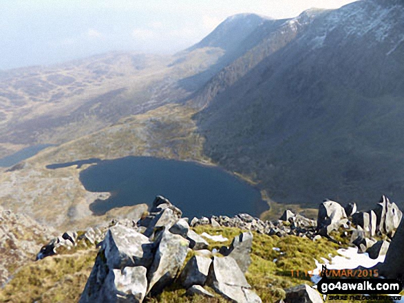
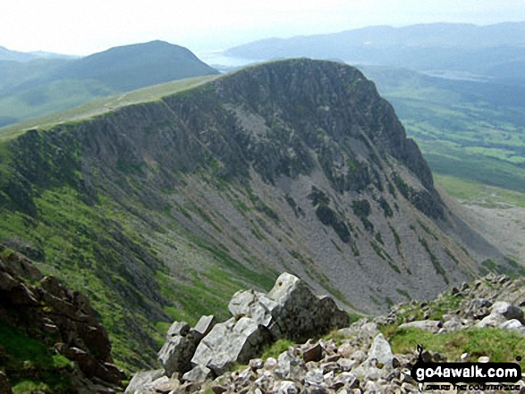
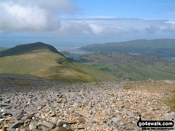
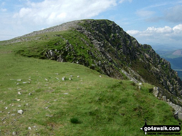
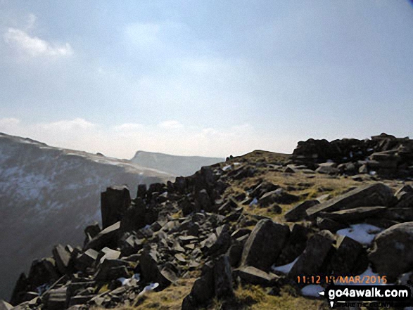
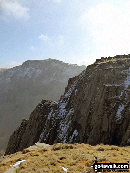
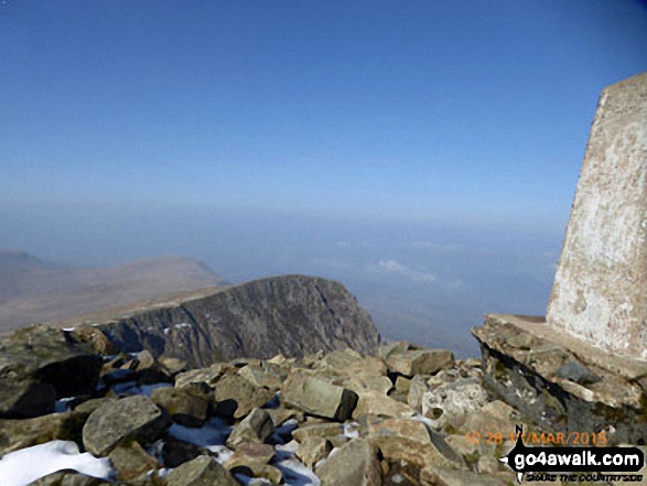
Mynydd Moel and Cadair Idris (Penygadair) from the Pony Path near Cyfrwy summit
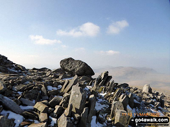
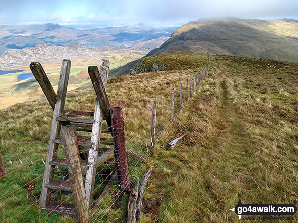
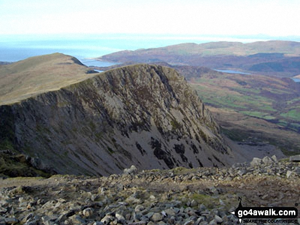
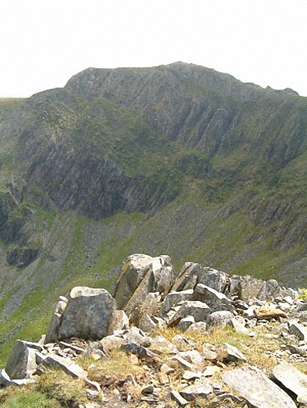
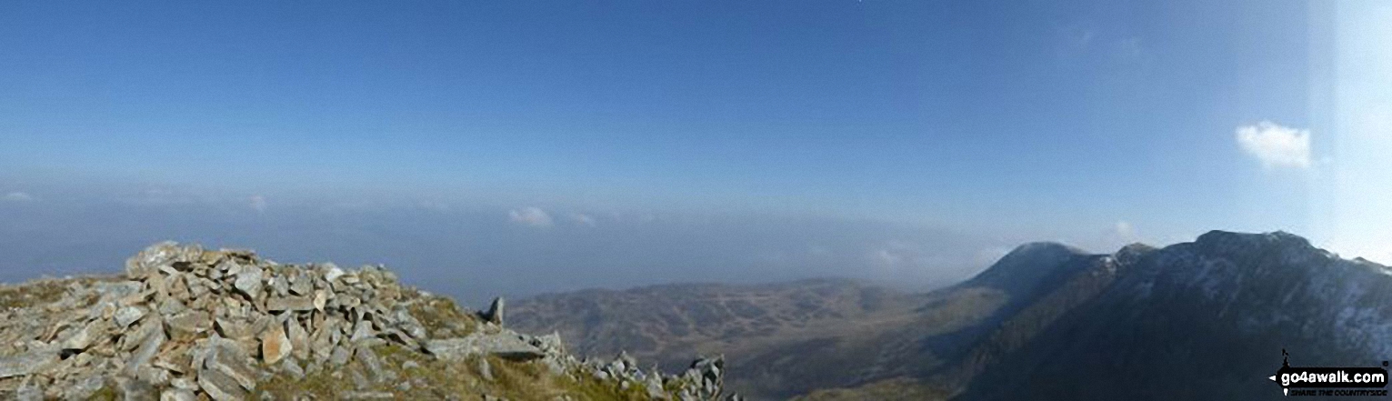
Ladder stile on the summit of Tyrrau Mawr (Craig-las) with Cyfrwy (The Saddle) and Cadair Idris (Penygadair) in the background
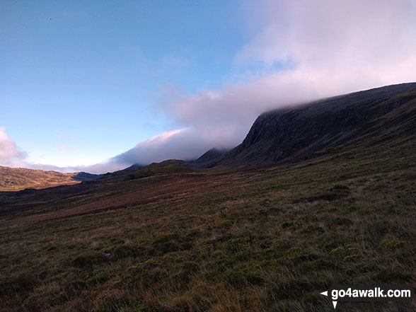
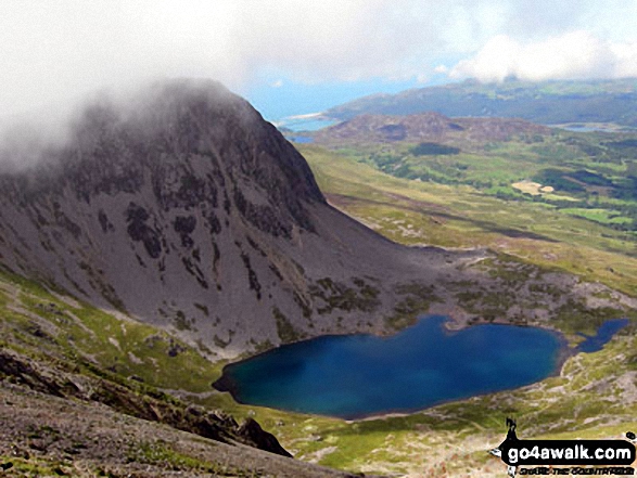
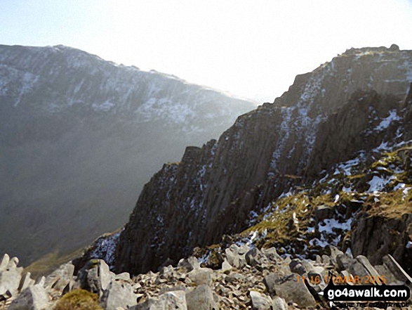
Cyfrwy (The Saddle) and Cadair Idris (Penygadair) consumed by cloud from Rhiw Gwredydd
. . . see all 26 walk photographs & pictures of views from, on or of Cyfrwy
Send us your photographs and pictures on, of, or from Cyfrwy
If you would like to add your walk photographs and pictures featuring views from, on or of Cyfrwy to this page, please send them as email attachments (configured for any computer) along with your name to:
and we shall do our best to publish them.
(Guide Resolution = 300dpi. At least = 660pixels (wide) x 440 pixels (high).)

You can also submit photos via our Facebook Page.
NB. Please indicate where each photo was taken.


