
![]()
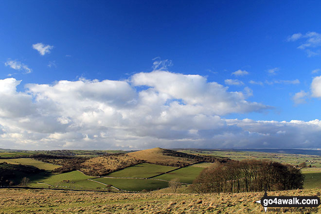
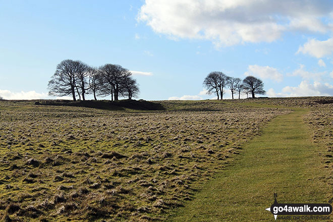
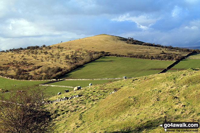
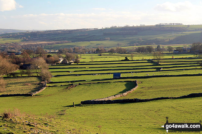
Longstone Moor
395m (1296ft)
The White Peak Area, The Peak District, Derbyshire, England
You can find Longstone Moor & all the walks that climb it on these unique free-to-access Interactive Walk Planning Maps: (click/TAP to select)
1:25,000 scale OS Explorer Map (the ones with orange/yellow covers):
1:50,000 scale OS Landranger Map (the ones with pink/magenta covers):
See Longstone Moor and the surrounding tops on our free-to-access 'Google Style' Peak Bagging Maps:
See Longstone Moor and the surrounding tops on our downloadable PDF Peak Bagging Map:
   |
|---|
Vital Statistics:
| Length: | 4.75ml (7.5km) |
|---|---|
| Ascent: | 791ft (241m) |
| Time: | 2½ hrs |
| Grade: |  (Easy) (Easy) |
Route Summary:
Great Longstone - Longstone Edge - High Rake - Watershaw Rake - Longstone Moor - Little Longstone - Monsal Head - Great Longstone
|
|---|
Vital Statistics:
| Length: | 11.75ml (19km) |
|---|---|
| Ascent: | 1,989ft (606m) |
| Time: | 6.25hrs |
| Grade: |  (Moderate) (Moderate) |
Route Summary:
Eyam - The Cliff - Stoney Middleton - Coombs Dale - Sallet Hole Mine - Rough Side - Black Harry Gate - Blakedon Hollow - High Rake - Longstone Edge - Watershaw Rake - Longstone Moor - Wardlow Hay Cop - Cressbrook Dale - Tansley Dale - Wardlow Mires - Stanley House Farm - Silly Dale - Foolow - Linen Dale - Eyam
 Fellow go4awalkers who have already walked, climbed, summited & bagged Longstone Moor
Adrian Garside walked up Longstone Moor on June 3rd, 2022 [from/via/route] Bank holiday weekend & I wanted to do a shortish walk with no people. This place is ideal. I had the dog so I didn't get much of a stroll round the top out of courtesy to the lambs. I kept him on the lead, & he ignores them, but no point causing unnecessary fear. Good views from the top [with] Dog [weather] Sunny, windy, 17C
Angela Haworth climbed Longstone Moor on February 10th, 2022 [from/via/route] Longstone Edge - Longstone Moor - Wardlow - Wardlow Hay Cop- Wardlow- Black Harry Gate - High Rake- Longstone Edge [weather] Sunny, snow, bitterly cold wind
Nicola Parkinson bagged Longstone Moor on May 4th, 2014 [from/via/route] D335 from Longstone Edge from Great Longstone [with] Stu [weather] Sunny
Mark Davidson hiked Longstone Moor on February 17th, 2014 [from/via/route] Walk d305 Stoney Middleton, Coombs Dale, Longstone Moor, Wardlow Hay Cop & Foolow from Eyam [with] Alone [weather] Nice & sunny
Andrew Joss summited Longstone Moor on March 2nd, 2014 [from/via/route] Eyam [with] Barbara [weather] Windy then very wet - Nice views
Eric Perry conquered Longstone Moor on April 7th, 2011 [from/via/route] Eyam, Stoney Middleton, Coombs Dale & Longstone Edge [with] Eric & Lynne [weather] Good
To add (or remove) your name and experiences on this page - Log On and edit your Personal Mountain Bagging Record
Send us your photographs and pictures on, of, or from Longstone Moor
If you would like to add your walk photographs and pictures featuring views from, on or of Longstone Moor to this page, please send them as email attachments (configured for any computer) along with your name to:
and we shall do our best to publish them.
(Guide Resolution = 300dpi. At least = 660pixels (wide) x 440 pixels (high).)

You can also submit photos via our Facebook Page.
NB. Please indicate where each photo was taken.


