
![]()
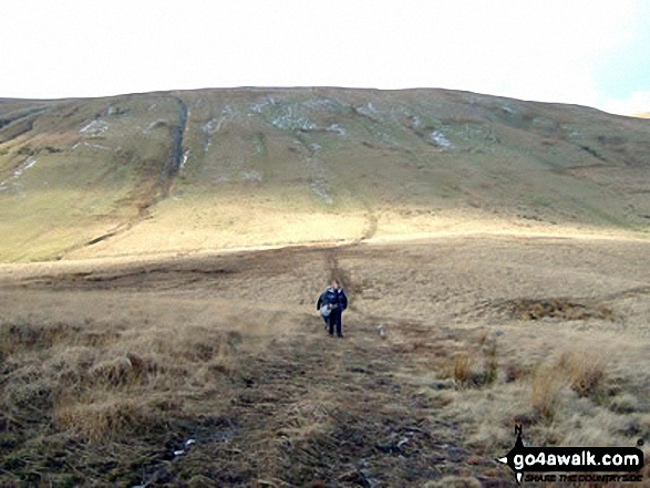
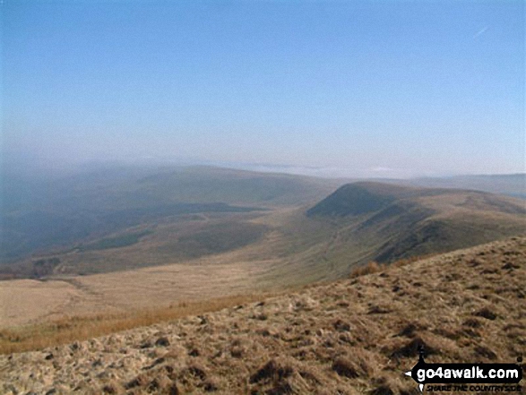
Pant y Creigiau
565m (1854ft)
The Brecon Beacons Area, The Brecon Beacons, Powys, Wales
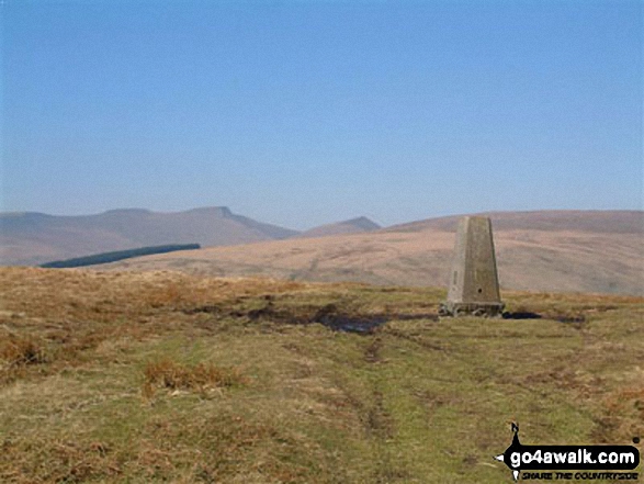
The summit of Pant y Creigiau is marked by an Ordnance Survey Trig Point.
You can find Pant y Creigiau & all the walks that climb it on these unique free-to-access Interactive Walk Planning Maps: (click/TAP to select)
1:25,000 scale OS Explorer Map (the ones with orange/yellow covers):
1:50,000 scale OS Landranger Map (the ones with pink/magenta covers):
See Pant y Creigiau and the surrounding tops on our free-to-access 'Google Style' Peak Bagging Maps:
See Pant y Creigiau and the surrounding tops on our downloadable PDF Peak Bagging Map:
   |
|---|
Vital Statistics:
| Length: | 5.5ml (9km) |
|---|---|
| Ascent: | 1,165ft (355m) |
| Time: | 3.25hrs |
| Grade: |  (Moderate) (Moderate) |
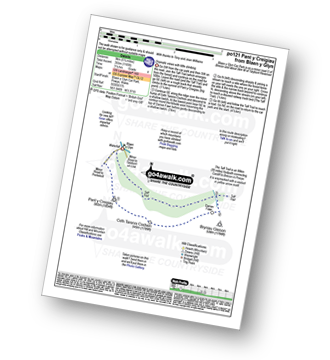
Route Summary:
Blaen y Glyn Uchaf - Pant y Creigiau - Cefn Tarenni Cochion - Bryniau Gleison - Darren Fach - The Taff Trail - Blaen y Glyn Uchaf.
|
|---|
Vital Statistics:
| Length: | 8.25ml (13km) |
|---|---|
| Ascent: | 1,257ft (383m) |
| Time: | 4.25hrs |
| Grade: |  (Moderate) (Moderate) |
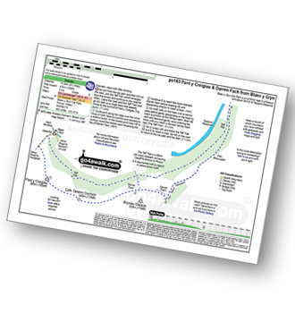
Route Summary:
Blaen y Glyn - Pant y Creigiau - Cefn Tarenni Cochion - Bryniau Gleison - Pen Bwlch Glasgwm - Pen Rhiw-calch - The Taff Trail - Blaen y Glyn
|
|---|
Vital Statistics:
| Length: | 13.25ml (21km) |
|---|---|
| Ascent: | 3,397ft (1,035m) |
| Time: | 8.25hrs |
| Grade: |  (Hard) (Hard) |
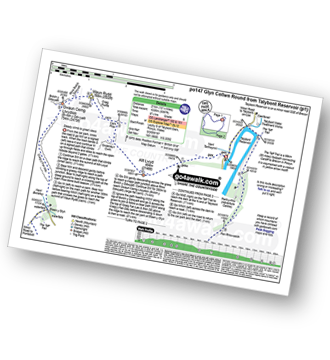
Route Summary:
Talybont Reservoir - Allt Lwyd - Gwalciau'r Cwm - Carn Pica - Craig Pwllfa - Waun Rydd - Gwaun Cerrig Llwydion (Bwlch y Ddwyallt) - Graig Fan Las - Craig y Fan Ddu - Blaen y Glyn - The Taff Trail - Pant y Creigiau - Cefn Tarenni Cochion - Bryniau Gleision (Talybont Reservoir) - Darren Fawr - Darren Fach - Pen Bwlch Glasgwm - Pen Rhiw-calch - The Taff Trail - Talybont Reservoir
 Fellow go4awalkers who have already walked, climbed, summited & bagged Pant y Creigiau
Jonathan Morris walked up Pant y Creigiau on March 19th, 2024 [from/via/route] Mountain Railway [with] My Father [weather] Cloudy but dry
Mark Davidson climbed Pant y Creigiau on August 13th, 2002 [from/via/route] Walk po121 Pant y Creigiau & Bryniau Gleison from Blaen y Glyn [with] Theresa [weather] Rather grey
Toby Norman bagged Pant y Creigiau on February 27th, 2022 [from/via/route] Taf Fechan Forest Carpark [with] Burrows
Sion Britton hiked Pant y Creigiau on January 5th, 2022 [from/via/route] O Maes Parcio Blaen y Glyn Uchaf. [with] Solo [weather] Oer/ Eira
Michael Rygol and Richard Penney have both walked, climbed & bagged Pant y Creigiau.
To add (or remove) your name and experiences on this page - Log On and edit your Personal Mountain Bagging Record
More Photographs & Pictures of views from, on or of Pant y Creigiau
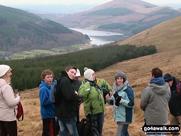
Jerusalem Baptist Church hike on Pant y Creigiau with Talybont Reservoir in the background
Send us your photographs and pictures on, of, or from Pant y Creigiau
If you would like to add your walk photographs and pictures featuring views from, on or of Pant y Creigiau to this page, please send them as email attachments (configured for any computer) along with your name to:
and we shall do our best to publish them.
(Guide Resolution = 300dpi. At least = 660pixels (wide) x 440 pixels (high).)

You can also submit photos via our Facebook Page.
NB. Please indicate where each photo was taken.


