
![]()
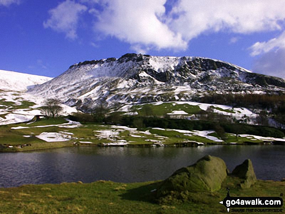
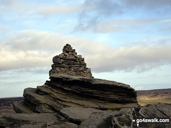
Great Dove Stone Rocks
450m (1477ft)
The Dark Peak Area, The Peak District, Greater Manchester, England
You can find Great Dove Stone Rocks & all the walks that climb it on these unique free-to-access Interactive Walk Planning Maps: (click/TAP to select)
1:25,000 scale OS Explorer Map (the ones with orange/yellow covers):
1:50,000 scale OS Landranger Map (the ones with pink/magenta covers):
See Great Dove Stone Rocks and the surrounding tops on our free-to-access 'Google Style' Peak Bagging Maps:
See Great Dove Stone Rocks and the surrounding tops on our downloadable PDF Peak Bagging Map:
   |
|---|
Vital Statistics:
| Length: | 6.25ml (10km) |
|---|---|
| Ascent: | 1,441ft (439m) |
| Time: | 3.75hrs |
| Grade: |  (Moderate) (Moderate) |
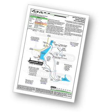
Route Summary:
Dove Stone Reservoir - Greenfield - The Oldham Way - Yeoman Hey Reservoir - Ashway Rocks - Ashway Gap - Dean Rocks - Great Dove Stone Rocks - Dove Stone Moss - Chew Reservoir - Chew Brook - Dove Stone Reservoir
|
|---|
Vital Statistics:
| Length: | 8.5ml (13.5km) |
|---|---|
| Ascent: | 1,848ft (563m) |
| Time: | 5 hrs |
| Grade: |  (Moderate) (Moderate) |
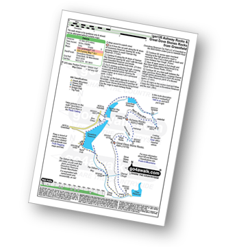
Route Summary:
Dove Stone Reservoir - Greenfield - The Oldham Way - Yeoman Hey Reservoir - Greenfield Reservoir - Birchin Clough - Raven Stones Brow - Ashway Rocks - Ashway Gap - Dean Rocks - Great Dove Stone Rocks - Dove Stone Moss - Chew Reservoir - Chew Brook - Dove Stone Reservoir
|
|---|
Vital Statistics:
| Length: | 11.5ml (18.5km) |
|---|---|
| Ascent: | 2,501ft (762m) |
| Time: | 6.75hrs |
| Grade: |  (Hard) (Hard) |
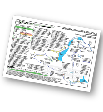
Route Summary:
Dove Stone Reservoir - Greenfield - The Oldham Way - Yeoman Hey Reservoir - Greenfield Reservoir - Birchin Clough - Raven Stones Brow - Ashway Rocks - Dean Rocks - Great Dove Stone Rocks - Chew Reservoir - Stable Stones Brow (Hoarstone Edge) - Alphin Pike - Dove Stone Reservoir
 Fellow go4awalkers who have already walked, climbed, summited & bagged Great Dove Stone Rocks
hannah1507 walked up Great Dove Stone Rocks on May 7th, 2023 [from/via/route] Walk gm150 Great Dove Stone Rocks Stable Stones Brow (Hoarstone Edge) from Dove Stone Reservoir, Greenfield [with] Solo
Andrew Flynn climbed Great Dove Stone Rocks on August 11th, 2020 [from/via/route] gm150 Great Dove Stone Rocks & Hoarstone Edge from Greenfield [weather] Very very sunny - Lovely route. Birchin Clough was a tricky climb. Some pathways close to the edge.
Christine Shepherd bagged Great Dove Stone Rocks on February 16th, 2019 [from/via/route] Walked from Dovestone Reservoir using walk gm114 [with] On my own [weather] Winter sunshine & some blue skies but very windy on the summit & along the ridge path. - A really enjoyable walk with great views & interesting stone formations. It is worth adding walk gm134 to this walk. There isn't much more climbing & it saves a lot of road walking.
Wayne Linley hiked Great Dove Stone Rocks on February 9th, 2019 [from/via/route] Dovestones car park [with] My mate Simon Flemming [weather] cloudy overcast strong wind . winter showers - Awesome water falls near Birchin clough
Margaret Richards summited Great Dove Stone Rocks on May 17th, 2012 [from/via/route] wy139 Great Dove Stone Rocks & Hoarstone Edge from Greenfield (11 ½ miles : grade 7: 150) [with] Don - Hard walk but good views
Martin Greenwood conquered Great Dove Stone Rocks on September 7th, 2014 [from/via/route] GM150 From Dovestones Reservoir. [with] Just me [weather] Warm & sunny.
John Gehrke scaled Great Dove Stone Rocks on July 31st, 2013 [from/via/route] Used walk gm114. [weather] Windy & rainy; the clouds broke occassionally to wonderful views. - Well worth the climb for the views.
Joanne Mcgawley walked up Great Dove Stone Rocks on May 4th, 2013 [with] Rich [weather] Very windy but clear - 8.77 miles
Deborah Lyon climbed Great Dove Stone Rocks on September 1st, 2012 [from/via/route] walk gm150 [with] Barry Lyon [weather] misty to start, but warm & sunny in the afternoon
Wendy Sockett, Louise Sandwith and Mark Davidson have all walked, climbed & bagged Great Dove Stone Rocks.
To add (or remove) your name and experiences on this page - Log On and edit your Personal Mountain Bagging Record
More Photographs & Pictures of views from, on or of Great Dove Stone Rocks
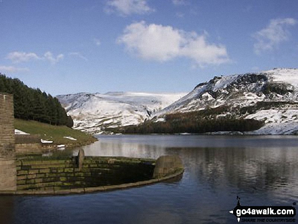
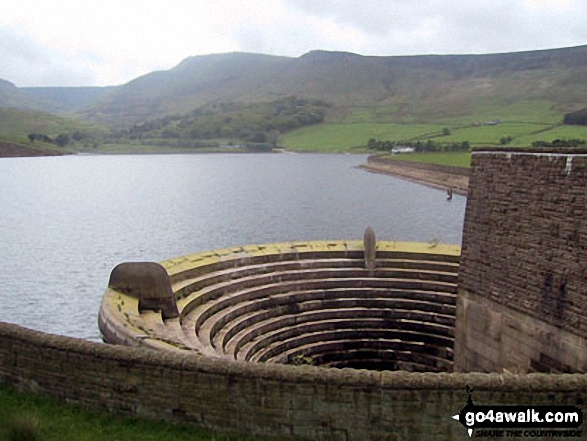
Dove Stone Reservoir overflow with snow on Great Dove Stone Rocks in the distance
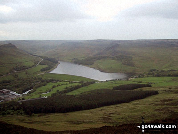
Dick Hill and Great Dove Stone Rocks above Dovestone Reservoir from Alphin Pike
Send us your photographs and pictures on, of, or from Great Dove Stone Rocks
If you would like to add your walk photographs and pictures featuring views from, on or of Great Dove Stone Rocks to this page, please send them as email attachments (configured for any computer) along with your name to:
and we shall do our best to publish them.
(Guide Resolution = 300dpi. At least = 660pixels (wide) x 440 pixels (high).)

You can also submit photos via our Facebook Page.
NB. Please indicate where each photo was taken.


