
![]()
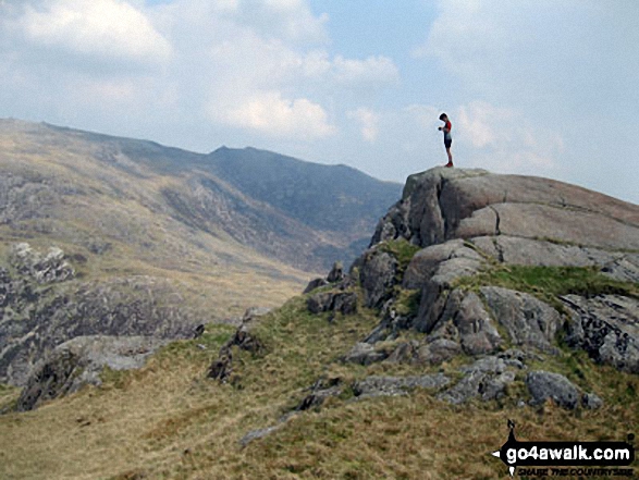
Craig Fach
609m (1999ft)
The Snowdon Area, Snowdonia, Gwynedd, Wales
Craig Fach means 'Small Crag' in Welsh and is pronounced 'cry-g vacht'.
You can find Craig Fach & all the walks that climb it on these unique free-to-access Interactive Walk Planning Maps: (click/TAP to select)
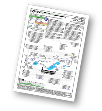
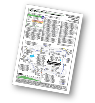
1:25,000 scale OS Explorer Map (the ones with orange/yellow covers):
1:50,000 scale OS Landranger Map (the ones with pink/magenta covers):
See Craig Fach and the surrounding tops on our free-to-access 'Google Style' Peak Bagging Maps:
See Craig Fach and the surrounding tops on our downloadable PDF Peak Bagging Map:
   |
|---|
Vital Statistics:
| Length: | 4.5ml (8.5km) |
|---|---|
| Ascent: | 1,562ft (476m) |
| Time: | 3½ hrs |
| Grade: |  (Moderate) (Moderate) |
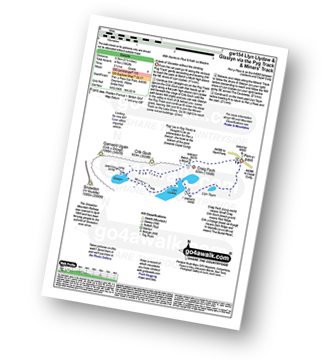
Route Summary:
Pen-y-Pass - Pyg Track - Bwlch y Moch - Craig Fach - Glaslyn - Miners' Track - Llyn Llydaw - Llyn Teyrn - Pen-y-Pass
|
|---|
Vital Statistics:
| Length: | 6ml (9.5km) |
|---|---|
| Ascent: | 2,424ft (739m) |
| Time: | 4½ hrs |
| Grade: |  (Moderate) (Moderate) |
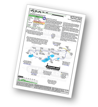
Route Summary:
Pen-y-Pass - Pyg Track - Bwlch y Moch - Craig Fach - Crib Goch - Bwlch Cove - Pyg Track - Pen-y-Pass
|
|---|
Vital Statistics:
| Length: | 7ml (11km) |
|---|---|
| Ascent: | 3,805ft (1,160m) |
| Time: | 6.25hrs |
| Grade: |  (Moderate) (Moderate) |
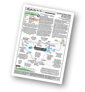
Route Summary:
Pen-y-Pass - Pyg Track - Bwlch y Moch - Craig Fach - Crib Goch - Garnedd Ugain (Crib y Ddysgl) - Snowdon Mountain Railway - Snowdon (Yr Wyddfa) - The Scree Path - Bwlch y Saethau - Bwlch Ciliau - Y Lliwedd - Y Lliwedd (East Top) - Lliwedd Bach - Miners' Track - Pen-y-Pass
|
|---|
Vital Statistics:
| Length: | 7.5ml (12km) |
|---|---|
| Ascent: | 3,034ft (925m) |
| Time: | 6 hrs |
| Grade: | (Moderate) |
Route Summary:
Pen-y-Pass - Pyg Track - Bwlch y Moch - Craig Fach - Miners' Track - Snowdon Mountain Railway - Snowdon (Yr Wyddfa) - Miners' Track - Glaslyn - Llyn Llydaw - Pen-y-Pass
|
|---|
Vital Statistics:
| Length: | 7.5ml (12km) |
|---|---|
| Ascent: | 4,100ft (1,250m) |
| Time: | 6½ hrs |
| Grade: |  (Hard) (Hard) |
Route Summary:
Pen-y-Pass - Pyg Track - Bwlch y Moch - Craig Fach - Crib Goch - Garnedd Ugain (Crib y Ddysgl) - Snowdon Mountain Railway - Snowdon (Yr Wyddfa) - The Scree Path - Bwlch y Saethau - Bwlch Ciliau - Y Lliwedd - Y Lliwedd (East Top) - Lliwedd Bach - Gallt y Wenallt - Afon Glaslyn - Miners' Track - Pen-y-Pass
 Fellow go4awalkers who have already walked, climbed, summited & bagged Craig Fach
Gavin Morton walked up Craig Fach on February 5th, 2022 [from/via/route] From pen-y-pass up Pyg track. Came back down Miners [weather] Very windy , wet with snow on the ground - Howling wind , didn't make summit conditions too bad. First time up Snowdon for me
Hugh Strickland climbed Craig Fach during 2018 [from/via/route] On Snowdon Horseshoe route in April
Michael Lee has bagged Craig Fach [from/via/route] Pen y Pass, Pyg Track, Bwlch y Moch, Craig Fach, Crib Goch, Garnedd Ugain (Crib y Ddysgl), Snowdon Mountain Railway, Snowdon (Yr Wyddfa), The Scree Path, Bwlch y Saethau, Bwlch Ciliau, Y Lliwedd, Y Lliwedd (East Top), Lliwedd Bach, Gallt y Wenallt, Afon Glaslyn, Miners' Track, Pen y Pass. [with] Gareth & John [weather] Warm sunny - Superb day!! Sore feet!
Simon Neilson-Clark hiked Craig Fach on June 3rd, 2018 [from/via/route] From Pyg track [with] Mrs H [weather] Sunny Hill fog
Mark Davidson and Paul Booth have both walked, climbed & bagged Craig Fach.
To add (or remove) your name and experiences on this page - Log On and edit your Personal Mountain Bagging Record
More Photographs & Pictures of views from, on or of Craig Fach
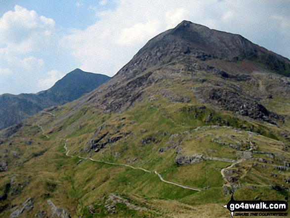
Crib Goch, Craig Fach and The PYG Track from the summit of Mount Snowdon (Yr Wyddfa)
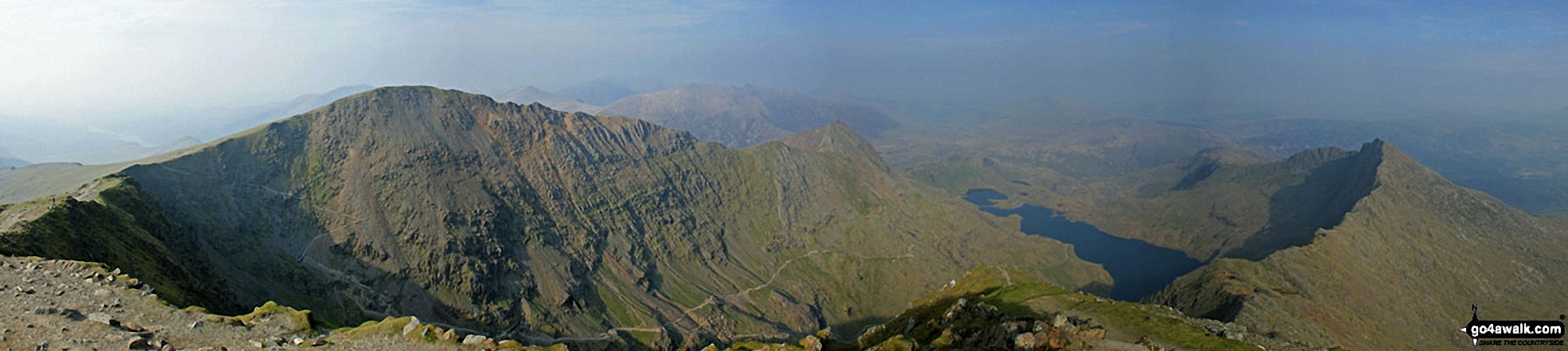
Garnedd Ugain (Crib y Ddysgl), Crib Goch, Craig Fach, The PYG Track, Llyn Llydaw and Y Lliwedd from the summit of Snowdon (Yr Wyddfa)
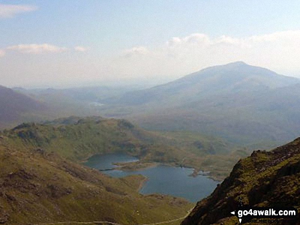
Craig Fach, Llyn Llydaw and Carnedd Moel Siabod from the Watkin Path on Bwlch Ciliau
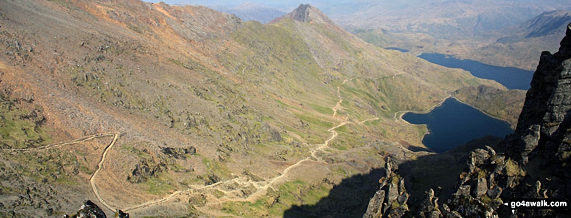
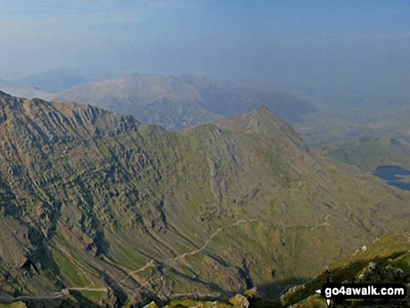
The PYG Track and The Miners' Track, Craig Fach, Llyn Llydaw (top) and Glaslyn (bottom) from Snowdon (Yr Wyddfa)
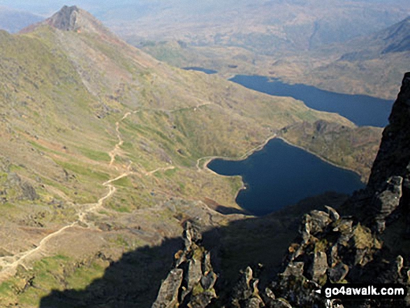
Craig Fach, Llyn Llydaw (top) and Glaslyn (bottom) from Snowdon (Yr Wyddfa)
Send us your photographs and pictures on, of, or from Craig Fach
If you would like to add your walk photographs and pictures featuring views from, on or of Craig Fach to this page, please send them as email attachments (configured for any computer) along with your name to:
and we shall do our best to publish them.
(Guide Resolution = 300dpi. At least = 660pixels (wide) x 440 pixels (high).)

You can also submit photos via our Facebook Page.
NB. Please indicate where each photo was taken.


