
![]()
Pen Bwlch Llandrillo Top
621m (2038ft)
The Berwyns, Denbighshire, Wales
*Pen Bwlch Llandrillo Top is actually just outside of The National Park Boundary
You can find Pen Bwlch Llandrillo Top & all the walks that climb it on these unique free-to-access Interactive Walk Planning Maps: (click/TAP to select)
1:25,000 scale OS Explorer Map (the ones with orange/yellow covers):
1:50,000 scale OS Landranger Map (the ones with pink/magenta covers):
Pen Bwlch Llandrillo Top on our free-to-access 'Google Style' Peak Bagging Map:
See Pen Bwlch Llandrillo Top and the surrounding tops on our downloadable PDF Peak Bagging Map:
   |
|---|
Vital Statistics:
| Length: | 10.25ml (16.5km) |
|---|---|
| Ascent: | 2,627ft (801m) |
| Time: | 6½ hrs |
| Grade: |  (Hard) (Hard) |
Route Summary:
Llandrillo - Pont Rhyd-yr-hydd - Bwlch Llandrillo Wayfarer Memorial - Pen Bwlch Llandrillo Top - Cadair Bronwen (North Top) - Cadair Bronwen - Bwlch Maen Gwynedd - Ffordd Gan Elin - Llandrillo
|
|---|
Vital Statistics:
| Length: | 12.25ml (19.5km) |
|---|---|
| Ascent: | 2,356ft (718m) |
| Time: | 6.75hrs |
| Grade: | (Hard) |
Route Summary:
Cynwyd - Afon Trystion - Cynwyd Forest - Pen Creigiau'r Barcut - Bwlch Cynwyd - Moel Fferna - Cerrig Coediog - Pan y Ladron - Pen Bwlch Llandrillo Top - Bwlch Llandrillo Wayfarer Memorial - Nant Gwyn - Nat y Cwm - Rhos-y-maerdy - Cynwyd
|
|---|
Vital Statistics:
| Length: | 15.5ml (25km) |
|---|---|
| Ascent: | 3,157ft (962m) |
| Time: | 8.75hrs |
| Grade: |  (Hard) (Hard) |
Route Summary:
Cynwyd - Afon Trystion - Cynwyd Forest - Pen Creigiau'r Barcut - Bwlch Cynwyd - Moel Fferna - Cerrig Coediog - Pan y Ladron - Pen Bwlch Llandrillo Top - Bwlch Llandrillo Wayfarer Memorial - Blaen Llynor - Cadair Bronwen (North Top) - Cadair Bronwen - Bwlch Llandrillo Wayfarer Memorial - Nant Gwyn - Nat y Cwm - Rhos-y-maerdy - Cynwyd
|
|---|
Vital Statistics:
| Length: | 16.25ml (26km) |
|---|---|
| Ascent: | 3,213ft (979m) |
| Time: | 9 hrs |
| Grade: | (Hard) |
Route Summary:
Llandrillo - Pont Rhyd-yr-hydd - Bwlch Llandrillo Wayfarer Memorial - Pen Bwlch Llandrillo Top - Bronwen (North Top) - Cadair Bronwen - Bwlch Maen Gwynedd - Craig Berwyn - Cadair Berwyn - Cadair Berwyn (North Top) - Moel Sych - Ceulan Myheryn - Milltir Gerrig - Blaen-y-cwm - Llandrillo
 Fellow go4awalkers who have already walked, climbed, summited & bagged Pen Bwlch Llandrillo Top
Mark Davidson walked up Pen Bwlch Llandrillo Top on August 1st, 2003 [from/via/route] Walk dn116 Moel Fferna, Pen Bwlch Llandrillo Top & Cadair Bronwen from Cynwyd [with] Alone [weather] Beautiful & sunny
Donovan Suddell climbed Pen Bwlch Llandrillo Top on March 6th, 2022 [from/via/route] Cynwyd [with] wife [weather] sunny, blustery at the top
Stephanie Doyle bagged Pen Bwlch Llandrillo Top on November 21st, 2021 [from/via/route] Llandrillo [with] Solo [weather] Windy - Just above the wayfarer monument & slightly to the left
David Wand hiked Pen Bwlch Llandrillo Top on May 29th, 2009 [with] Solo [weather] Rained in the night but dry for the walk & a light breeze
Trevor Williams and Paul Booth have both walked, climbed & bagged Pen Bwlch Llandrillo Top.
To add (or remove) your name and experiences on this page - Log On and edit your Personal Mountain Bagging Record
More Photographs & Pictures of views from, on or of Pen Bwlch Llandrillo Top
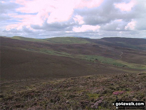
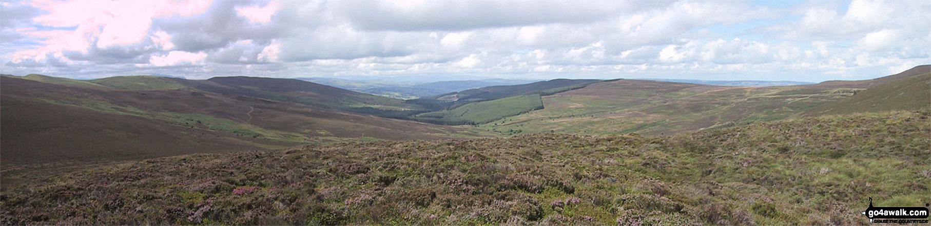
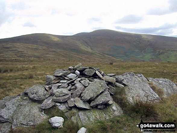
Pen Bwlch Llandrillo Top, Nant Croes-y-wernen, Pen Creigau'r, and Moel Fferna from the summit of Cerrig Coediog
Send us your photographs and pictures on, of, or from Pen Bwlch Llandrillo Top
If you would like to add your walk photographs and pictures featuring views from, on or of Pen Bwlch Llandrillo Top to this page, please send them as email attachments (configured for any computer) along with your name to:
and we shall do our best to publish them.
(Guide Resolution = 300dpi. At least = 660pixels (wide) x 440 pixels (high).)

You can also submit photos via our Facebook Page.
NB. Please indicate where each photo was taken.


