
![]()
Garnedd-goch
700m (2297ft)
The Moel Hebog Area, Snowdonia, Gwynedd, Wales
Garnedd-goch means 'Red Cairn' in Welsh and is pronounced 'ga-neth goch'.
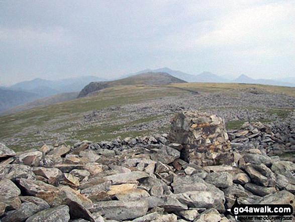
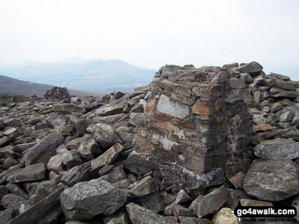
The summit of Garnedd-goch is marked by a derelict Trig Point.
You can find Garnedd-goch & all the walks that climb it on these unique free-to-access Interactive Walk Planning Maps: (click/TAP to select)
1:25,000 scale OS Explorer Map (the ones with orange/yellow covers):
1:50,000 scale OS Landranger Map (the ones with pink/magenta covers):
See Garnedd-goch and the surrounding tops on our free-to-access 'Google Style' Peak Bagging Maps:
See Garnedd-goch and the surrounding tops on our downloadable PDF Peak Bagging Map:
   |
|---|
Vital Statistics:
| Length: | 5mls (8km) |
|---|---|
| Ascent: | 1,778ft (542m) |
| Time: | 3½ hrs |
| Grade: |  (Moderate) (Moderate) |
Route Summary:
Cors y Llyn - Afon Cwm Dulyn - Braich y Llyn - Garnedd-goch - Bwlch Cwmdulyn - Mynydd Graig Goch - Cors y Llyn
|
|---|
Vital Statistics:
| Length: | 7mls (11.5km) |
|---|---|
| Ascent: | 2,123ft (647m) |
| Time: | 4.75hrs |
| Grade: |  (Moderate) (Moderate) |
Route Summary:
Cors y Llyn - Afon Cwm Dulyn - Braich y Llyn - Garnedd-goch - Clogwyn y Cysgod - Craig yr Ogof - Craig Cwm Silyn - Garnedd-goch - Bwlch Cwmdulyn - Mynydd Graig Goch - Cors y Llyn
|
|---|
Vital Statistics:
| Length: | 11.5ml (18.5km) |
|---|---|
| Ascent: | 4,496ft (1,370m) |
| Time: | 8.75hrs |
| Grade: |  (Hard) (Hard) |
Route Summary:
Rhyd-Ddu - Y Garn (Moel Hebog) - The Nantlle Ridge - Mynydd Drws-y-coed - Trum y Ddysgl - The Hiatus - Mynydd Tal-y-mignedd - Bwlch Dros-bern - Craig Cwm Silyn - Garnedd-goch - Craig Cwm Silyn - Cwm Pennant - Bwlch y Ddwy Elor - Beddgelert Forest - Cwm Marchnad - Llyn-y-Gader - Rhyd-Ddu
 Fellow go4awalkers who have already walked, climbed, summited & bagged Garnedd-goch
Melfyn Parry walked up Garnedd-goch on June 7th, 2023 [from/via/route] Started walk from the parking area at Llyn Cwm Dulyn, quite close to the footbridge. The intention was to follow route GW203, however as there were 4 of us & the weather was really nice we decided to extend the route. We followed various paths from the footbridge until we joined a tarmac road at SH49160 51157 & then turned right up the hill. At the top there is a gate leading on to the moorland which brings you to Llynnau Cwm Silyn, walk in between the two lakes & then head on up to the obelisk on Tal y Mignedd. From here we descended on easy to follow paths to Bwlch Dros Bern & then headed for the top of Craig Cwm Silyn. From here we followed Route GW203 to pass over the top of Garnedd Goch & then Mynydd Graig Goch before dropping down the path to the other side of Llyn Cwm Dulyn & back to the car. [with] With DS, KG and BM [weather] Sunny & reasonably warm all day. Visibility was excellent - Stunning views in all directions from the summits. Extending the route made it a 10 mile walk rather than the 7 miles quoted for GW203
Beccy Long climbed Garnedd-goch on February 15th, 2023 [with] Anna [weather] Cloudy
Mark Davidson bagged Garnedd-goch on August 5th, 2003 [from/via/route] Walk gw164 The full Nantlle Ridge & Craig Cwm Silyn from Rhyd-Ddu [with] Alone [weather] Nice & sunny - perfect conditions for top ridge walks in the UK
Andy Buxton hiked Garnedd-goch during August, 1964 [from/via/route] End of Nantlle Ridge [with] Dad
Christina Lander summited Garnedd-goch on August 16th, 2016 [from/via/route] Nantlle Ridge Rhyd-Ddu - Y Garth - Mynydd Drws Y Coed - Trum Y Ddysgl - Mynydd Tal Y Mignedd - Craig Cwm Silyn - Garnedd Goch - Mynydd Craig Goch - Llyn Cwm Dulyn - Nebo [with] Dick [weather] Perfect sunny day
Louis Smith has walked, climbed & bagged Garnedd-goch.
To add (or remove) your name and experiences on this page - Log On and edit your Personal Mountain Bagging Record
More Photographs & Pictures of views from, on or of Garnedd-goch
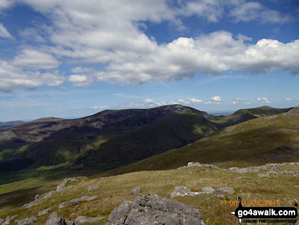
The Nantlle Ridge - Garnedd-goch, Craig Cwm Silyn, Mynydd Tal-y-mignedd, Bwlch Dros-bern and Mynydd Drws-y-coed - from Moel Yr Ogof

The Nantlle Ridge - Garnedd-goch, Craig Cwm Silyn, Mynydd Tal-y-mignedd, Bwlch Dros-bern, Trum y Ddysgl and Mynydd Drws-y-coed - from Moel Lefn
Send us your photographs and pictures on, of, or from Garnedd-goch
If you would like to add your walk photographs and pictures featuring views from, on or of Garnedd-goch to this page, please send them as email attachments (configured for any computer) along with your name to:
and we shall do our best to publish them.
(Guide Resolution = 300dpi. At least = 660pixels (wide) x 440 pixels (high).)

You can also submit photos via our Facebook Page.
NB. Please indicate where each photo was taken.


