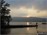
Lake Windermere - its glacial past explored by British Geological Survey
I've often looked down on Lake Windermere when walking around Loughrigg Fell or Orrest Head and mused about what might lie beneath the water. And not surprisingly - I'm not alone because scientists from the British Geological Survey (BGS) have just completed the first full survey of Lake Windermere since the Royal Navy in the 1930s.
The survey team are investigating what is happening currently on the lake bed - the sedimentation, variations in temperature and other changes in the marine habitat that will potentially impact the species that live there, for example the Arctic Charr. These links between the geology and biology of Windermere are being investigated in collaboration with the Centre for Hydrology and Ecology.
The BGS team are also trying to get a better understanding of what happened beneath the lake bed during the last ice age. It's known that the British ice sheet extended as far as Windermere but how quickly did it retreat, did it leave any moraines (deposits of sediment formed as glaciers advance and retreat) and what impact overall have these glacial processes had on the water sheds and drainage into the lake since then?
Much of the data for this survey is being collected from a specially adapted catamaran, The White Ribbon. Whilst from a distance, this could be mistaken for one of the many day boats that usually sail around Windermere, this little boat is packed full of computer monitors and scientific equipment notably a multibeam sonar system that is lowered into the water through a 'moon pool' in the centre of its deck. The sonar system 'paints a picture' of the lake bed using sound. Sonar heads send out 508 sound waves that 'ping' the bottom of the Lake (or anything else there). From the time taken for the ping to return, the instrument can calculate the distance travelled and hence the depth of water.
The sonar system is connected to an on-board computer which displays the data in real-time on a series of monitors allowing the scientists to identify the areas mapped and the depth of the water as the survey proceeds. All the data is then transferred to computers on the shore for full analysis.
The analysis completed so far has shown that there is a very large 'bump' in the middle of the lake - where the ferry runs currently - and where the water is only 2 metres deep. This is a remnant of Windermere's glacial past and was probably formed from the outwash of debris deposited by the glacier. Preliminary analysis suggests that this a terminal moraine (or ridge) which was formed at the 'snout' of the glacier.
The data collected in this study will be used for research, as a navigation guide for the Lake Wardens and - in conjunction with other organisations such as the Lake District National Park Authority and a local aquarium - for the development of a 3D fly though of the Lake Bed for tourists.
There is, of course, Bownessie* ..... but so far she's kept out of the way of the BGS survey team but how will she react to all this activity?
For more information on the BGS Windermere survey
For a selection of walks around Windermere
*Bownessie is the Windermere version of the Loch Ness Monster. There are various reports of sightings since the 70s of an 'unusual' creature swimming in the Lake. It featured in the ITV programme 'The Lakes' earlier this year and has been the subject of more recent 'hunts' using boats, sonar and cameras.
The views expressed by contributors to this discussion are not necessarily those held by go4awalk.com.
Add your comment to THIS article | Start a NEW Discussion
To contribute to go4awalk.com or to contact us about anything at all - see Talk To Us. For help see Help.
go4awalk.com and go4awalk.co.uk are registered trademarks of TMDH Limited.
Copyright © 2000-2024 TMDH Limited. All rights reserved.
Copyright | Terms & Conditions | Privacy Statement
A - Z
Walks
Home
Log On/Accounts
Photo Gallery
Walk Ideas and Collections
Fell Facts
Places to Stay
Hill Skills
Walking Questions and Answers
Your Stories
News
Competitions
Product Reviews/Gear Tests
Walking Gear Guides
Peaks and Mountains
Peak Bagging
Find New Walking Friends
Camping
GPS Waypoints for Walking
Walk Search
Talk to us
go4awalk.com Help
Free example walks
Newsletter


